Framed Nautical Charts
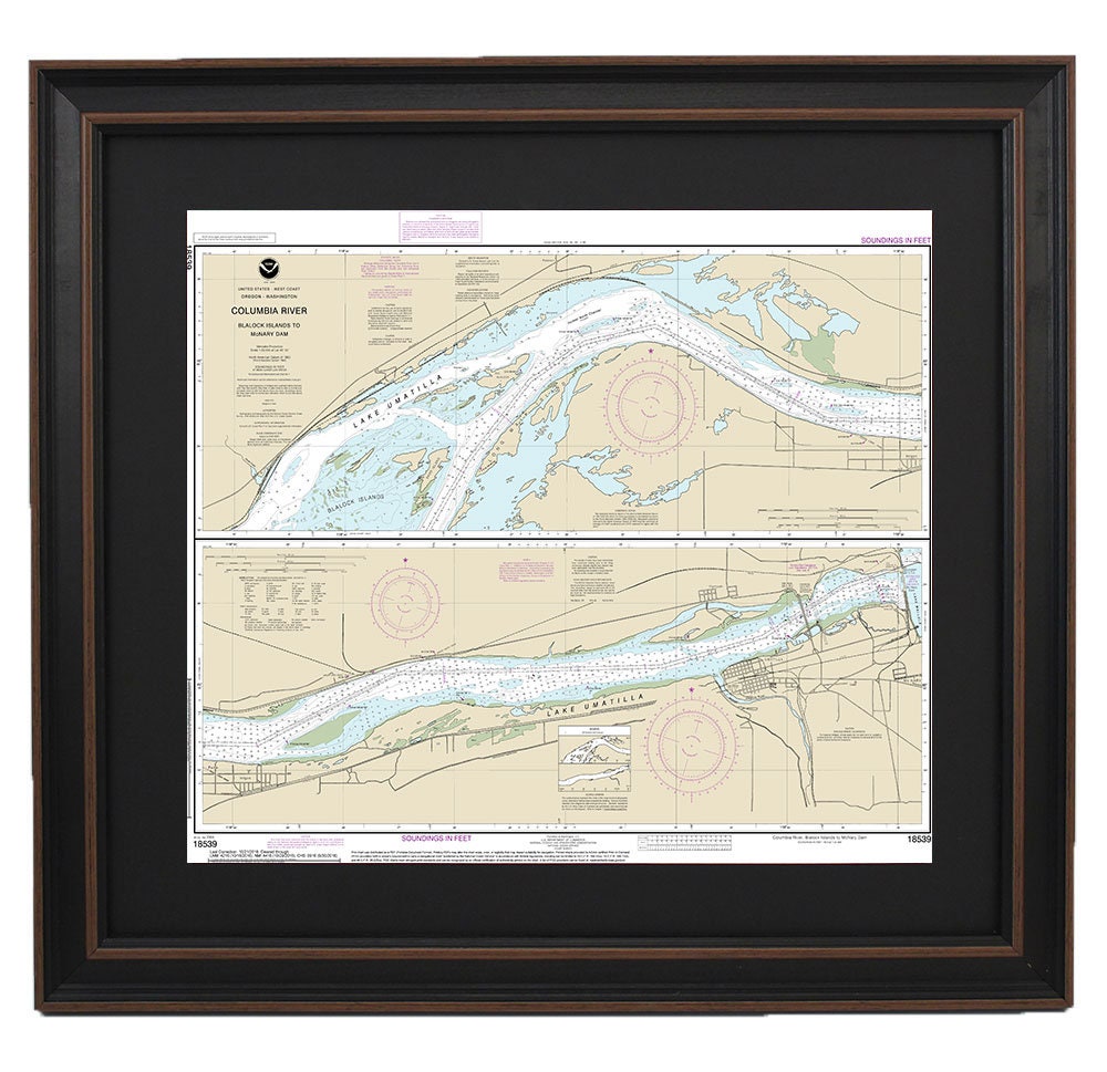
Framed Nautical Chart 18539 - Columbia River. Blalock Islands to McNary Dam. NOAA 18539. Handmade in the USA.
Framed Nautical Chart 18539 - Columbia River. Blalock Islands to McNary Dam. NOAA 18539. Handmade in the USA.
Couldn't load pickup availability
Discover the beauty of the Columbia River with this exquisite framed nautical map, featuring the route from Blalock Islands to McNary Dam. This official NOAA nautical chart (18539) is a stunning representation of Oregon’s waterways, expertly handcrafted in the USA to meet high standards of quality and craftsmanship.
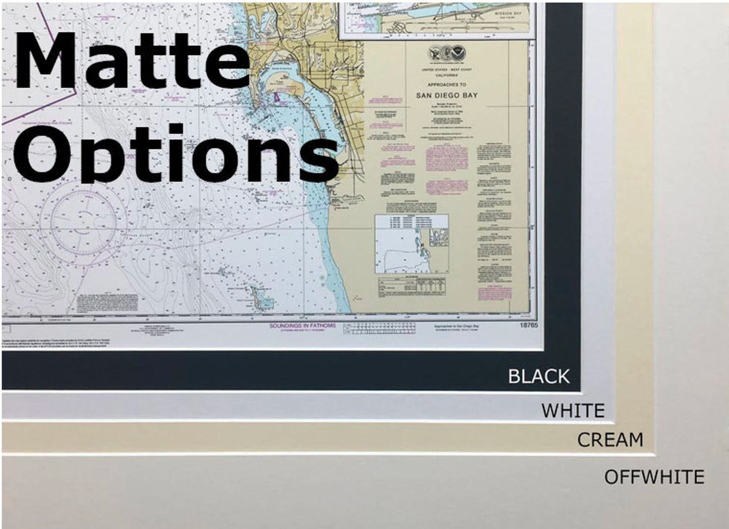
Each chart is elegantly presented in a solid wood frame and showcases a museum-quality print made with archival paper and inks, ensuring durability and vibrant colors. The design includes a sophisticated black mat and is protected by a glass front, making it a perfect addition to any home or office décor. The back is thoughtfully finished with a paper duster and includes a wire hanger for easy installation.
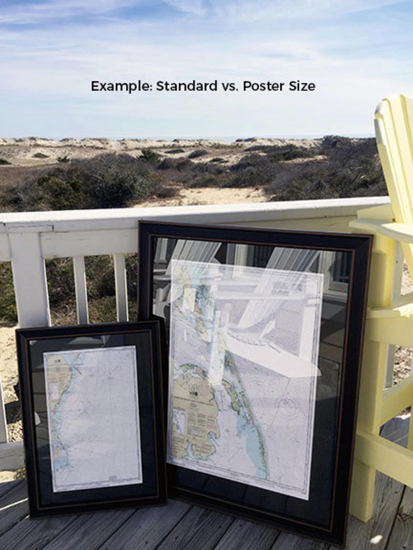
Choose from two sizes to best suit your space:
- Standard size: outer frame dimensions approximately 24" H x 20" W
- Poster size: outer frame dimensions approximately 36" H x 30" W
Every framed chart is made with attention to detail, ensuring you receive a unique piece that enhances your environment. Enjoy the convenience of free ground shipping to the 48 contiguous states. If you're interested in custom frame options or have sample photos to share, please reach out to us.
*Important Shipping Note: Free ground shipping applies only within the contiguous United States. For custom shipping quotes to Alaska and Hawaii, please contact us directly.
Share