Framed Nautical Charts
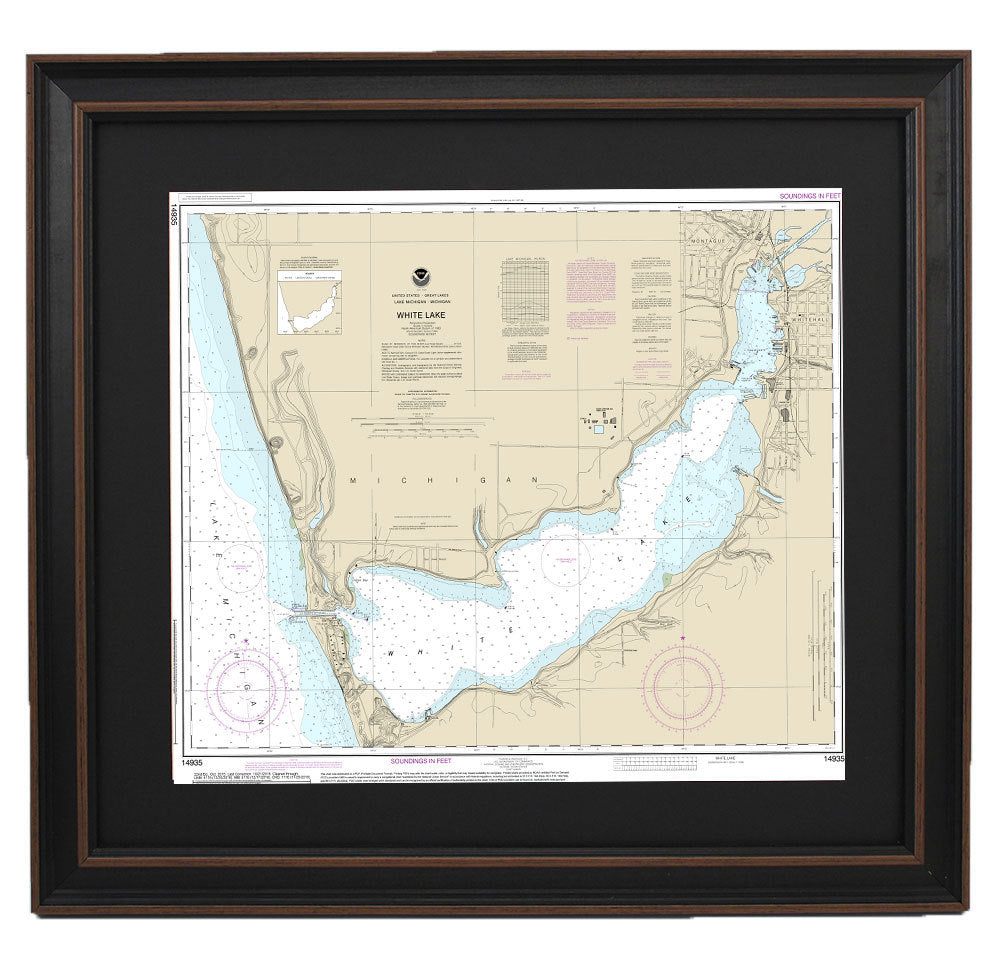
Framed Nautical Chart 14935 - White Lake. NOAA 14935. Handmade in the USA.
Framed Nautical Chart 14935 - White Lake. NOAA 14935. Handmade in the USA.
Couldn't load pickup availability
This beautifully framed nautical map showcases the stunning waters of White Lake, situated off the shores of Lake Michigan. It features the official NOAA Nautical Chart, expertly detailing the intricate waterways of this picturesque region in Michigan. Each chart is custom handcrafted in the USA, reflecting exceptional standards of craftsmanship and attention to detail.
The map is elegantly presented in a solid wood frame, complete with a museum-quality print that uses archival paper and inks for lasting vibrancy. The presentation is enhanced by a black mat and protected with a glass front, ensuring both durability and visual appeal. The back is neatly finished with paper dust backing, and a wire hanger is included for easy installation.
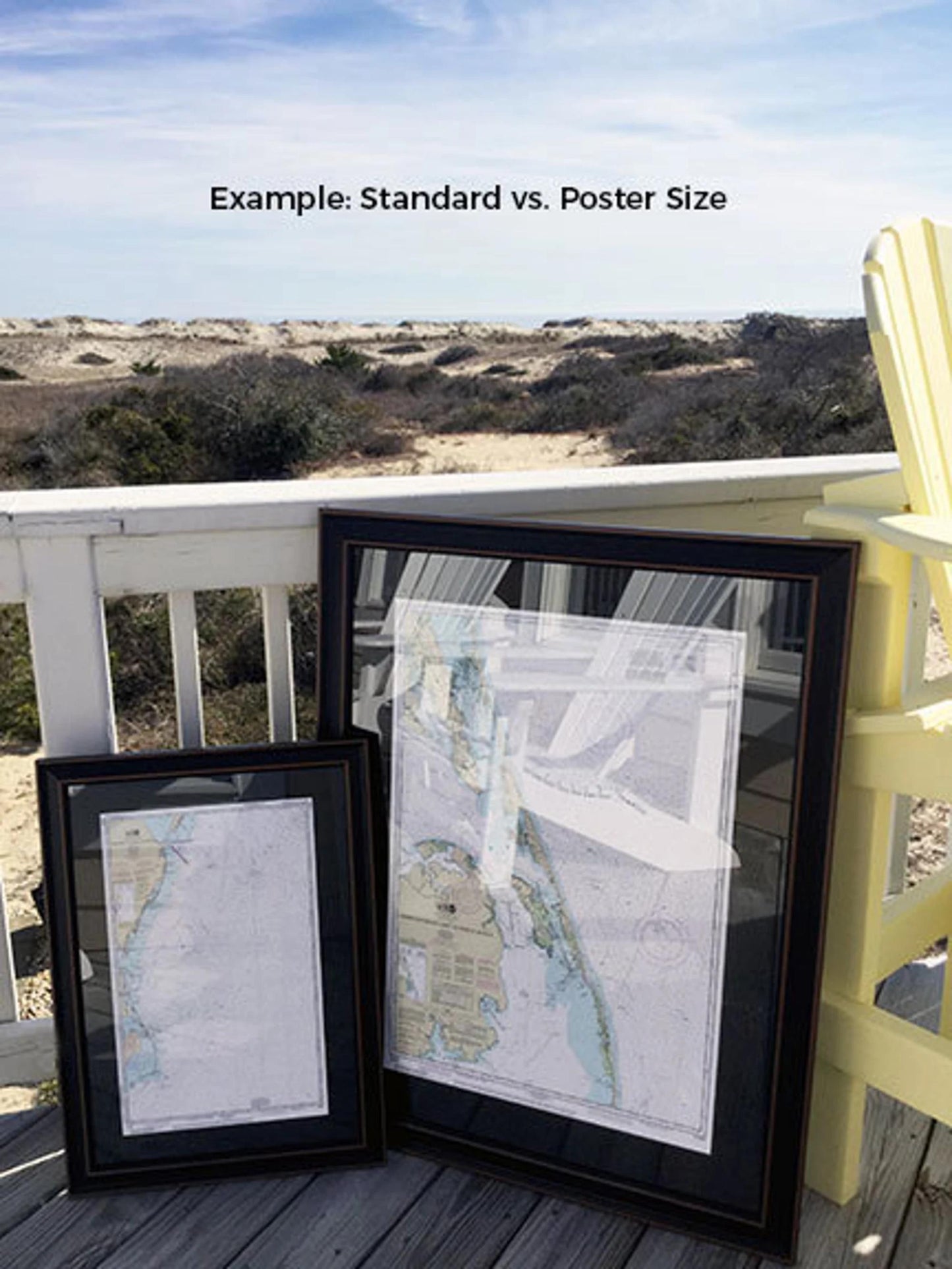
Our framed nautical charts are available in two sizes:
- Standard size: Approximately 24" W x 20" H
- Poster size: Approximately 36" W x 30" H
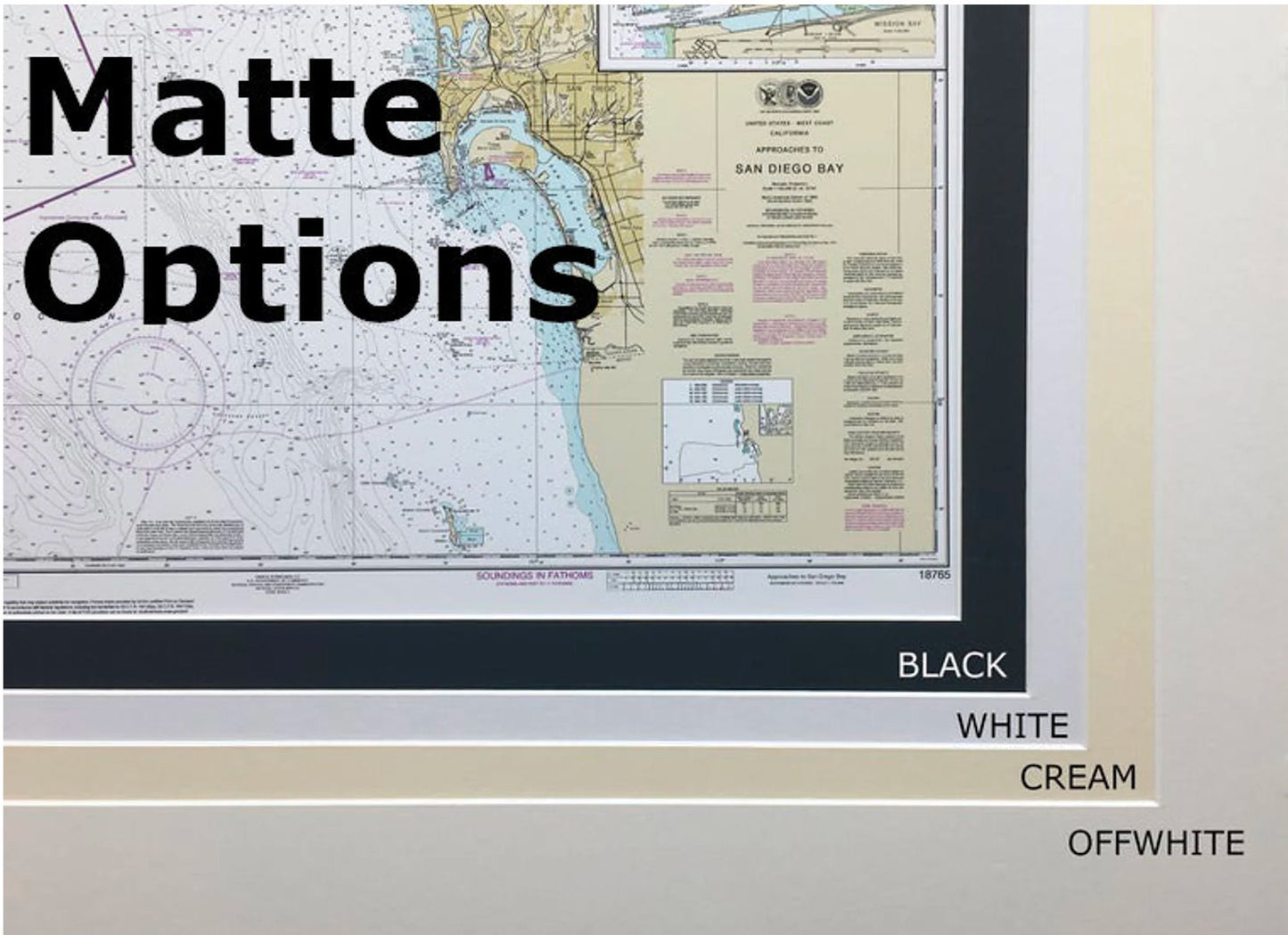
If you desire a different frame option or have specific design requests, please don't hesitate to contact us. We are committed to helping you create the perfect piece that matches your vision.
*Important Shipping Note: Free ground shipping is offered only for deliveries within the 48 contiguous states. We do not add extra charges to shipping costs; however, due to the high expenses associated with shipping to Alaska and Hawaii, please reach out for a custom shipping quote.
Share