Framed Nautical Charts
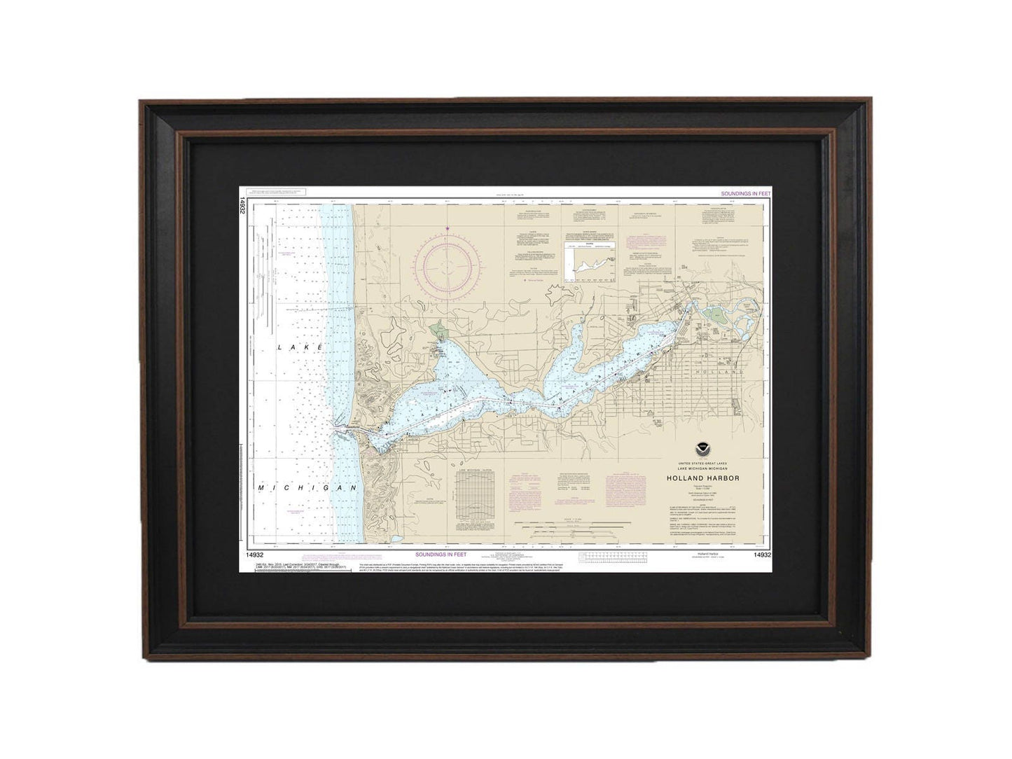
Framed Nautical Chart 14932 - Holland Harbor, Lake Michigan. NOAA 14932. Handmade in the USA.
Framed Nautical Chart 14932 - Holland Harbor, Lake Michigan. NOAA 14932. Handmade in the USA.
Couldn't load pickup availability
Discover the beauty of Holland Harbor on Lake Michigan with this exquisite framed nautical chart, NOAA Chart 14932. This official nautical map captures the stunning waterways of the area, serving as both a functional guide and a striking piece of artwork. Each chart is meticulously handmade in the USA, showcasing exceptional craftsmanship and attention to detail.
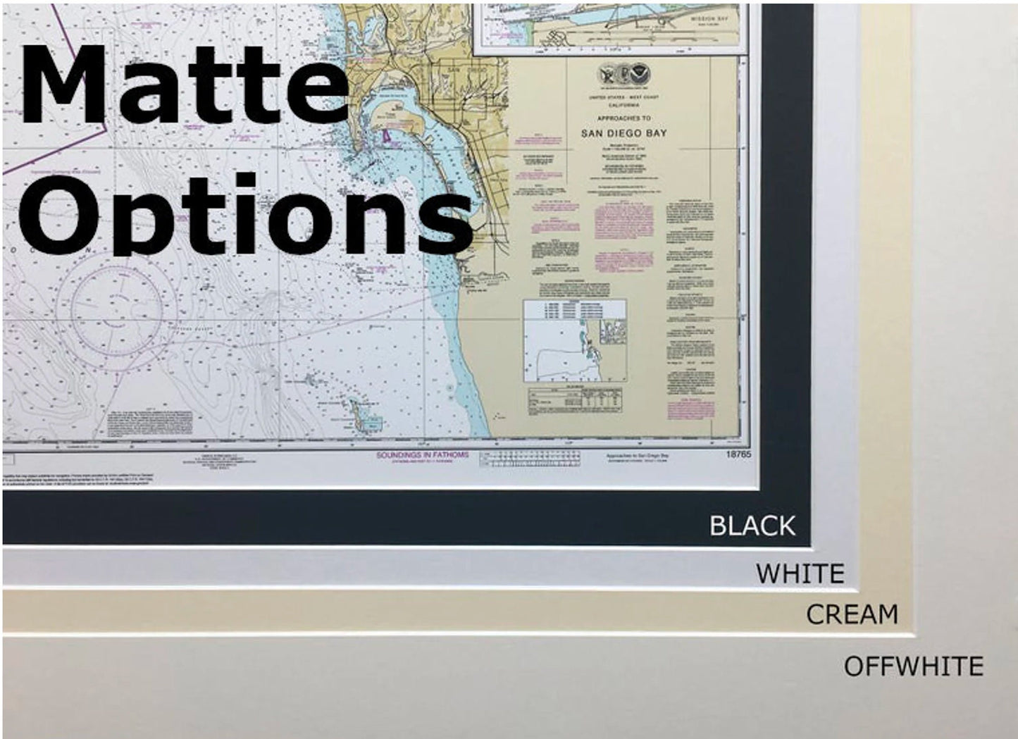
The chart is displayed in a solid wood frame, offering durability and elegance. It features a museum-quality print made from archival paper and inks, ensuring long-lasting vibrancy and clarity. A classic black mat enhances the visual appeal, while the glass front protects the artwork from dust and damage. The back is finished with a paper duster for a polished look, and it includes a convenient wire hanger for easy installation.
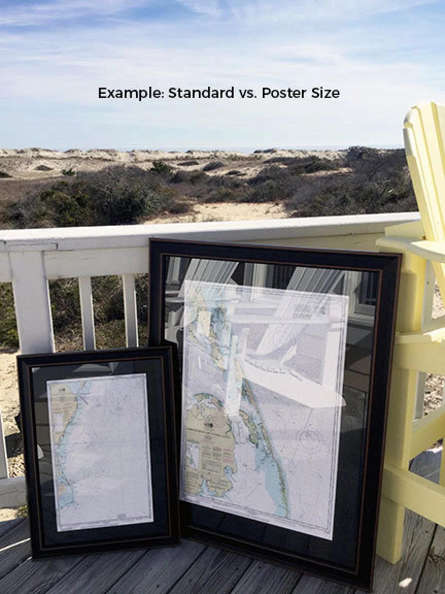
Available in two sizes, you can choose the perfect fit for your space:
- Standard size: Outer frame dimensions are approximately 24" W x 17 1/4" H
- Poster size: Outer frame dimensions are approximately 36" W x 26" H
If you are interested in a custom frame option, please reach out to us with your specific requests, and feel free to share any sample photos you have to help us create your vision.
*Important Shipping Note: We offer free ground shipping for orders shipped within the 48 contiguous states. While we do not add extra charges for shipping, please contact us for custom shipping quotes to Alaska and Hawaii, as those rates can be significantly higher.
Share