Framed Nautical Charts
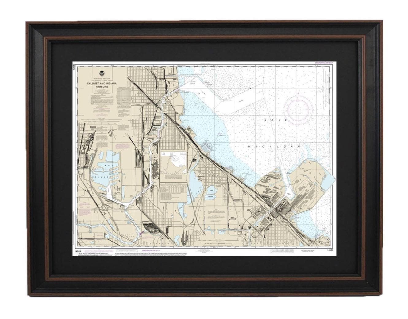
Framed Nautical Chart 14929 - Lake Michigan Calumet and Indiana Harbors. NOAA 14929. Handmade in the USA.
Framed Nautical Chart 14929 - Lake Michigan Calumet and Indiana Harbors. NOAA 14929. Handmade in the USA.
Couldn't load pickup availability
Discover the beauty of Lake Michigan with this Framed Nautical Chart, specifically NOAA 14929, showcasing Calumet, Indiana, Buffington Harbors, and Lake Calumet. This official NOAA Nautical Chart is an exquisite representation of the region's intricate waterways. Each chart is meticulously handmade in the USA, ensuring a high standard of craftsmanship.
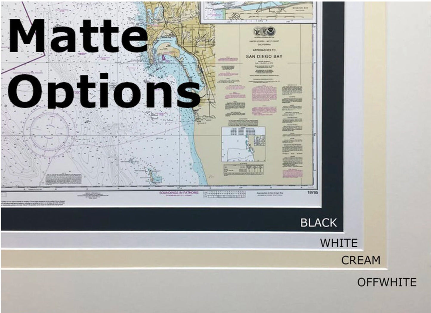
The nautical map is elegantly presented in a solid wood frame and features a museum-quality print made from archival paper and inks, ensuring longevity and vibrancy. It is enhanced with a sophisticated black mat and protected by a glass front, adding a touch of elegance to any space. The back is neatly finished with a paper duster, and a wire hanger is included for easy installation.
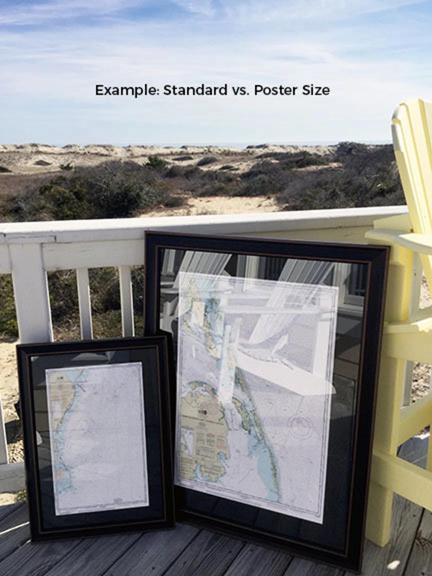
This framed chart is available in two sizes:
- Standard size: outer frame dimensions approximately 24" W x 17.5" H
- Poster size: outer frame dimensions approximately 36" W x 26.5" H
If you're interested in a different frame option, we encourage you to reach out with your request, and feel free to share any sample photos that will help us bring your vision to life.
*Important Shipping Note: Free ground shipping is available for shipments within the 48 contiguous states. We do not mark up shipping costs, but due to higher shipping rates to Alaska and Hawaii, please contact us for a custom shipping quote.
Share