Framed Nautical Charts
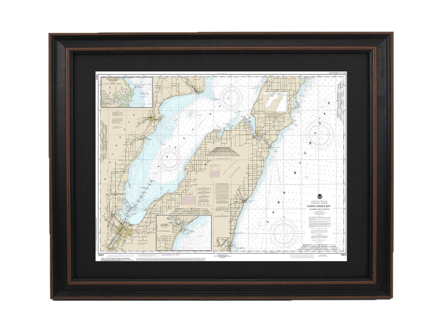
Framed Nautical Chart 14910 - Lake Michigan Lower Green Bay. NOAA 14910. Handmade in the USA.
Framed Nautical Chart 14910 - Lake Michigan Lower Green Bay. NOAA 14910. Handmade in the USA.
Couldn't load pickup availability
Discover the charm of Lake Michigan's Lower Green Bay with our beautifully framed nautical map, NOAA Chart 14910. This stunning piece covers iconic locations such as Oconto Harbor and Algoma, showcasing the intricate details of these picturesque waters. Each chart is meticulously handcrafted in the USA, ensuring superior craftsmanship and quality.
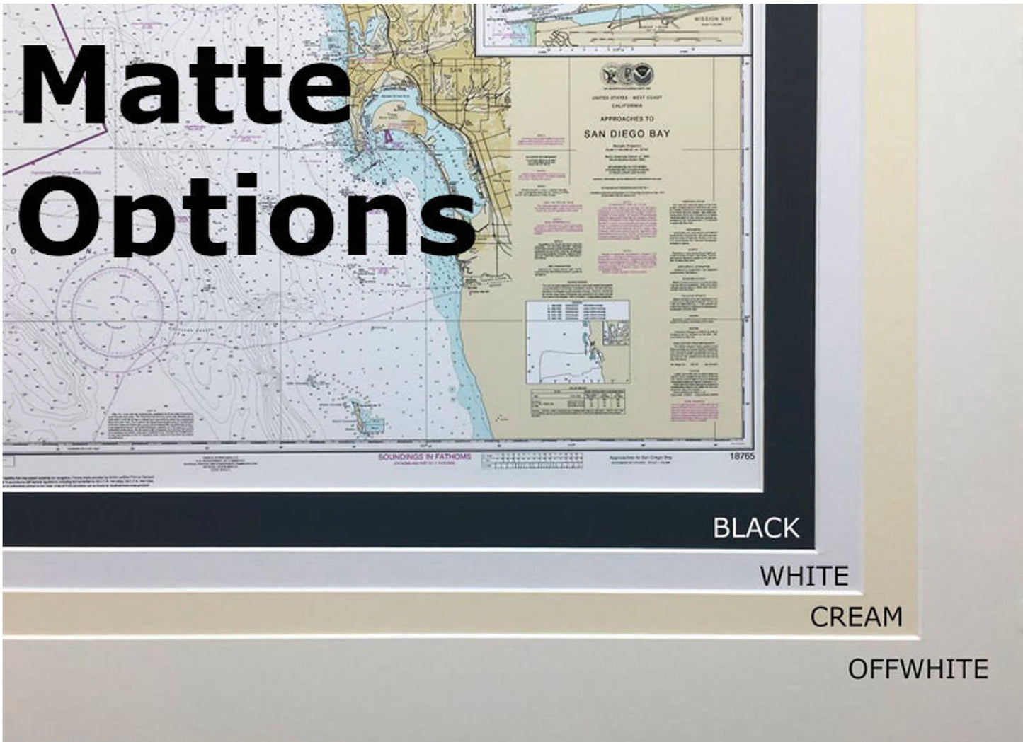
Our framed nautical chart is presented in a solid wood frame, complemented by a museum-quality print made from archival paper and inks, allowing you to enjoy its beauty for years to come. It features a sleek black mat and is protected by a glass front, making it a perfect addition to your home or office decor. The back is finished with a paper duster for a polished look, and a wire hanger is included for easy installation.
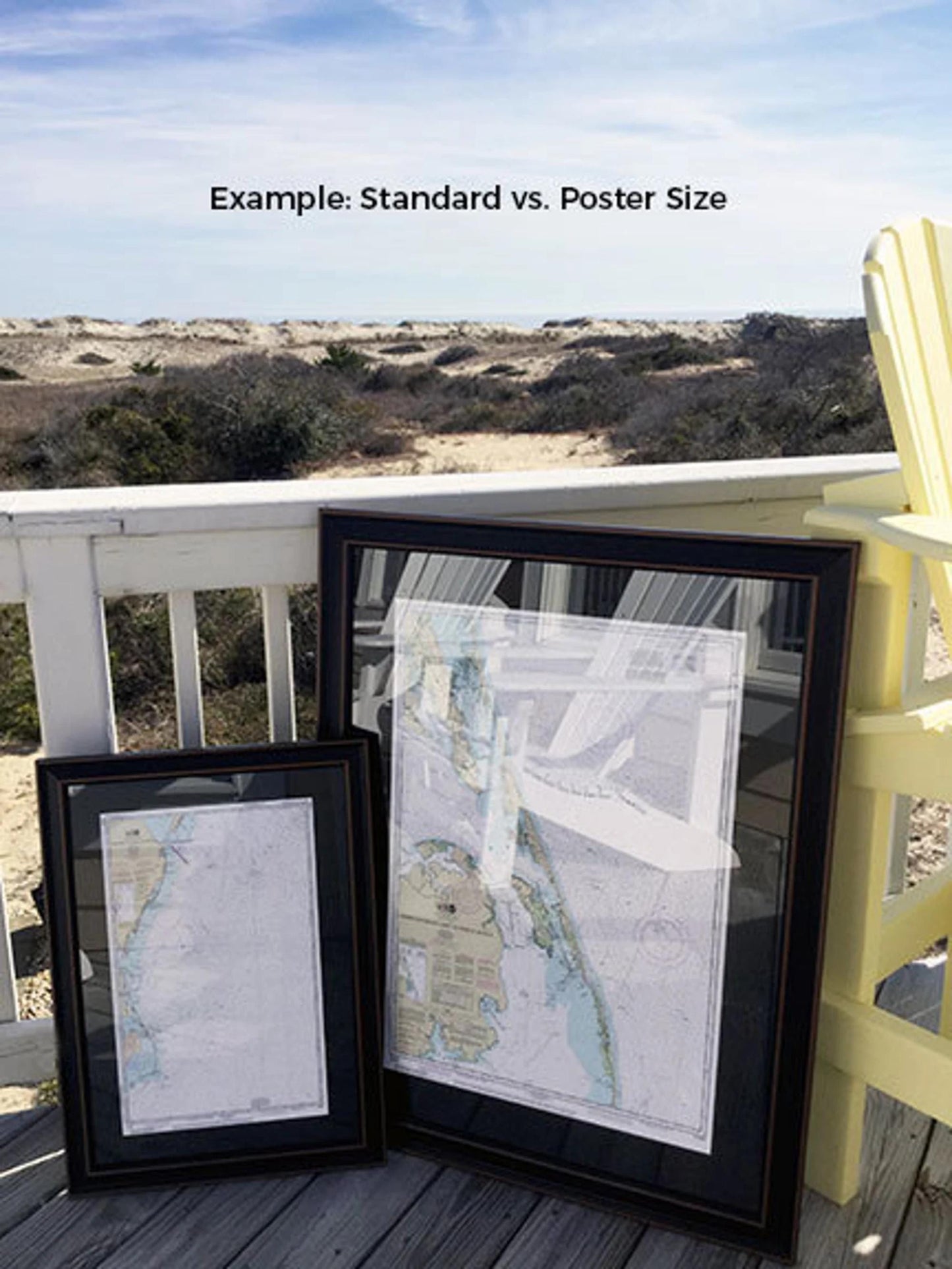
Available in two sizes to fit your needs:
- Standard size: Outer frame dimensions are approximately 24" W x 18" H
- Poster size: Outer frame dimensions are approximately 36" W x 27" H
If you're seeking a specific frame option or have sample photos to share, please don't hesitate to reach out. We're happy to collaborate with you to create your ideal nautical chart display.
*Important Shipping Note: Free ground shipping is available for orders shipped to the contiguous 48 states. While we do not increase shipping costs, please contact us for customized shipping quotes for destinations in Alaska and Hawaii, as shipping fees may vary significantly.
Share