Framed Nautical Charts
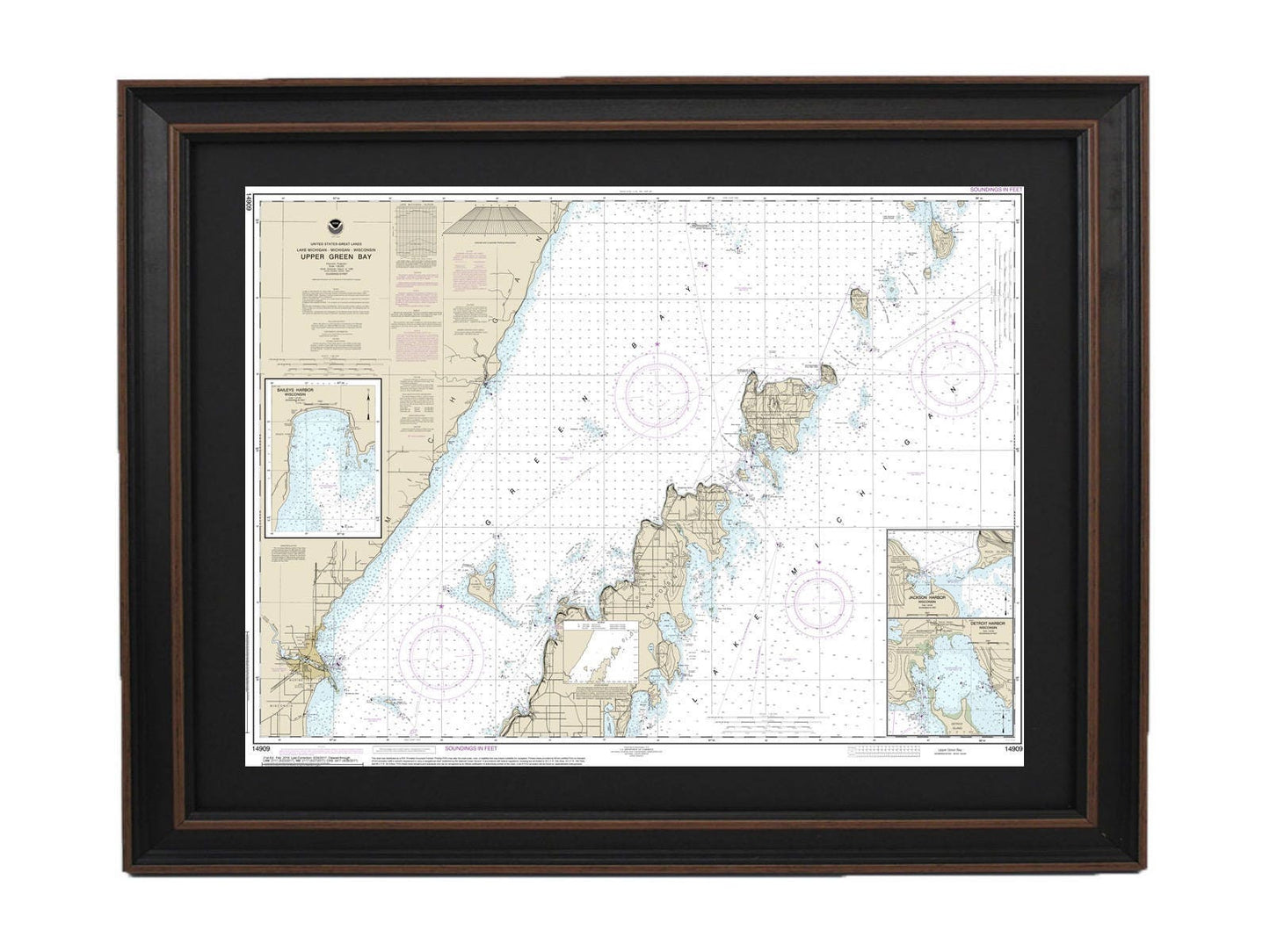
Framed Nautical Chart 14909 - Lake Michigan Upper Green Bay. NOAA 14909. Handmade in the USA.
Framed Nautical Chart 14909 - Lake Michigan Upper Green Bay. NOAA 14909. Handmade in the USA.
Couldn't load pickup availability
Discover our exquisite Framed Nautical Chart of Lake Michigan's Upper Green Bay, featuring detailed illustrations of Jackson Harbor, Detroit Harbor, and Baileys Harbor. This official NOAA Nautical Chart not only showcases the beauty of these waters but is also a testament to high-quality craftsmanship, as each chart is custom handmade in the USA.
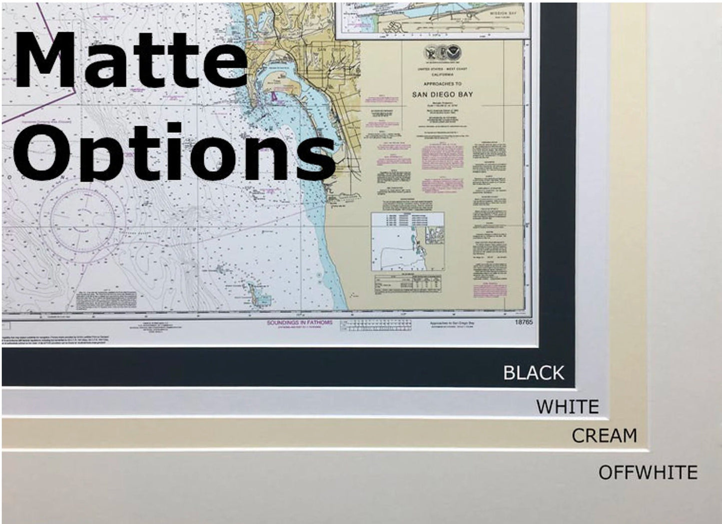
The chart is elegantly presented in a solid wood frame, accompanied by a museum-quality print crafted from archival paper and inks, ensuring durability and vibrancy. The design includes a sophisticated black mat and is protected by a glass front, giving it a polished and professional appearance. The back is finished with a paper duster for a clean look, and a wire hanger is included for easy installation.
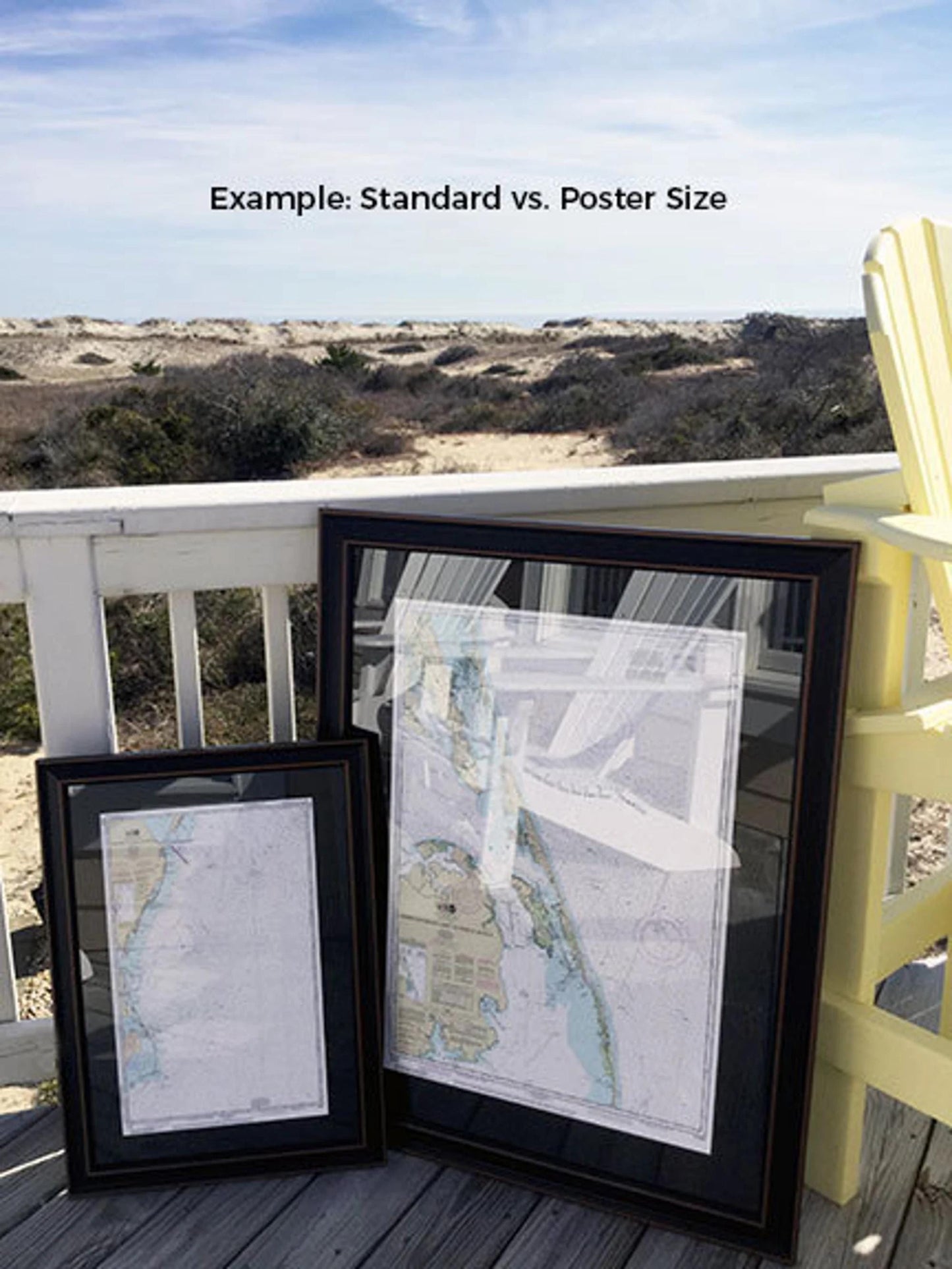
Available in two frame sizes to suit your space:
- Standard size: outer dimensions approximately 24" W x 17 3/4" H
- Poster size: outer dimensions approximately 36" W x 26 3/4" H
If you have a different framing option in mind, please feel free to reach out with your request. We're happy to work with any sample photos you provide to help us create your perfect piece.
*Important Shipping Note: We offer free ground shipping to the 48 contiguous states. While we do not charge extra shipping fees, please contact us for custom quotes if you are located in Alaska or Hawaii due to the higher shipping costs.
Share