Framed Nautical Charts
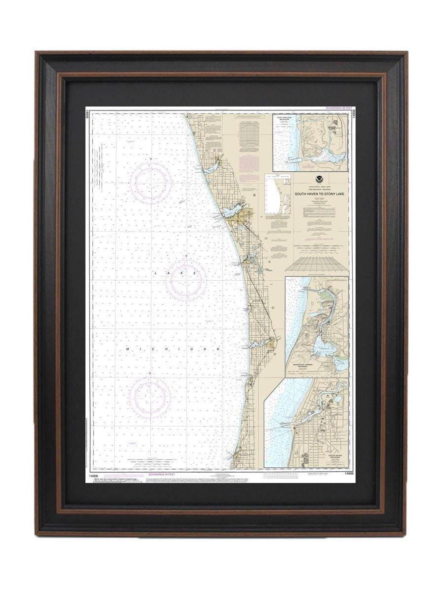
Framed Nautical Chart 14906 - Lake Michigan South Haven to Stony Lake. NOAA 14906. Handmade in the USA.
Framed Nautical Chart 14906 - Lake Michigan South Haven to Stony Lake. NOAA 14906. Handmade in the USA.
Couldn't load pickup availability
Discover the beauty of Lake Michigan with this Framed Nautical Chart, expertly crafted to showcase the stunning waters from South Haven to Stony Lake, including Port Sheldon and Saugatuck Harbor. This official NOAA Nautical Chart features intricate details of these captivating waterways, making it a perfect addition to your home or office decor.
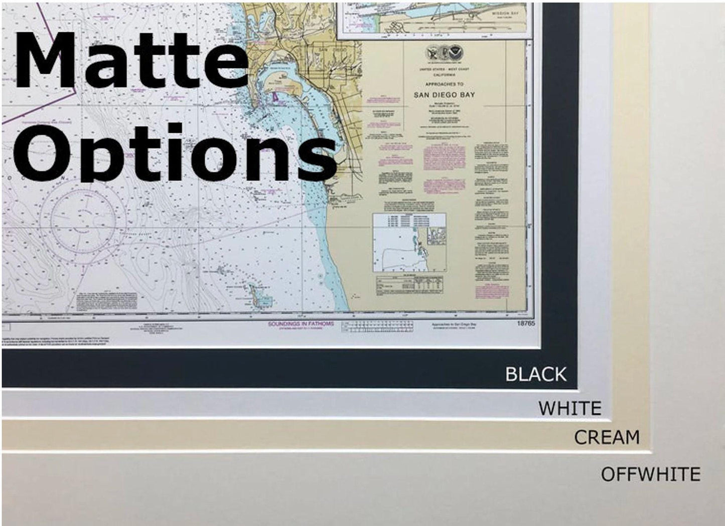
Each chart is meticulously handmade in the USA, reflecting a commitment to high standards of craftsmanship. Presented in a solid wood frame, the chart displays a museum-quality print made from archival paper and inks, ensuring longevity and vibrancy. The design is completed with an elegant black mat and a protective glass front, enhancing its visual appeal. The back is thoughtfully finished with a paper duster, and a wire hanger is included for easy installation.
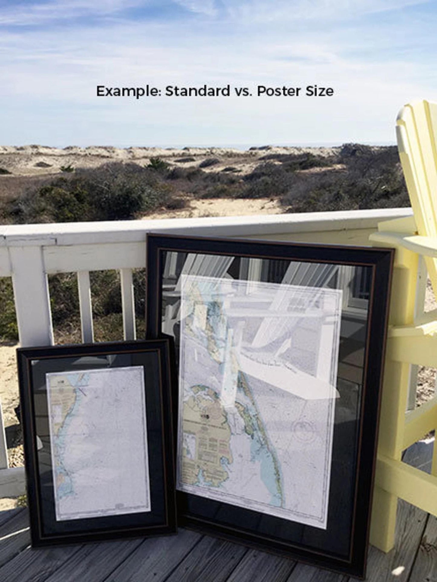
Choose from two convenient frame sizes:
- Standard size: Outer frame dimensions of approximately 17" W x 24" H
- Poster size: Outer frame dimensions of approximately 25 3/4" W x 36" H
If you have a specific frame option in mind, feel free to reach out to us with your request. We also welcome any sample photos to help us bring your vision to life.
*Important Shipping Note: Free ground shipping is available for shipments to the 48 contiguous states. While we do not inflate shipping costs, we recommend contacting us for custom shipping quotes due to the higher rates for Alaska and Hawaii.
Share