Framed Nautical Charts
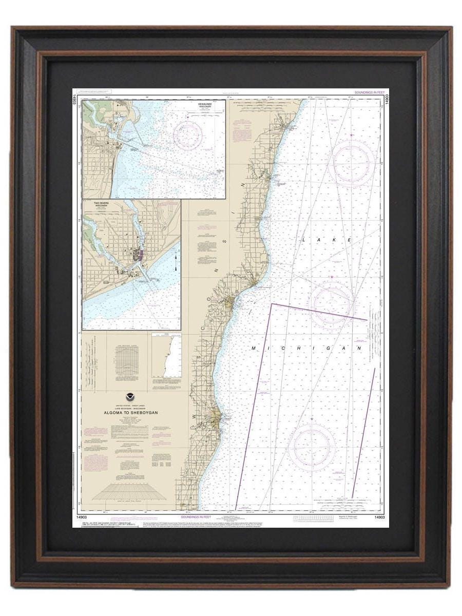
Framed Nautical Chart 14903 - Lake Michigan, Algoma to Sheboygan. NOAA 14903. Handmade in the USA.
Framed Nautical Chart 14903 - Lake Michigan, Algoma to Sheboygan. NOAA 14903. Handmade in the USA.
Couldn't load pickup availability
Explore the captivating waterways of Lake Michigan with our framed nautical chart, which beautifully details the region from Algoma to Sheboygan, including Kewaunee and Two Rivers. This officially sanctioned NOAA nautical chart serves as both a functional navigational tool and an exquisite piece of maritime art.
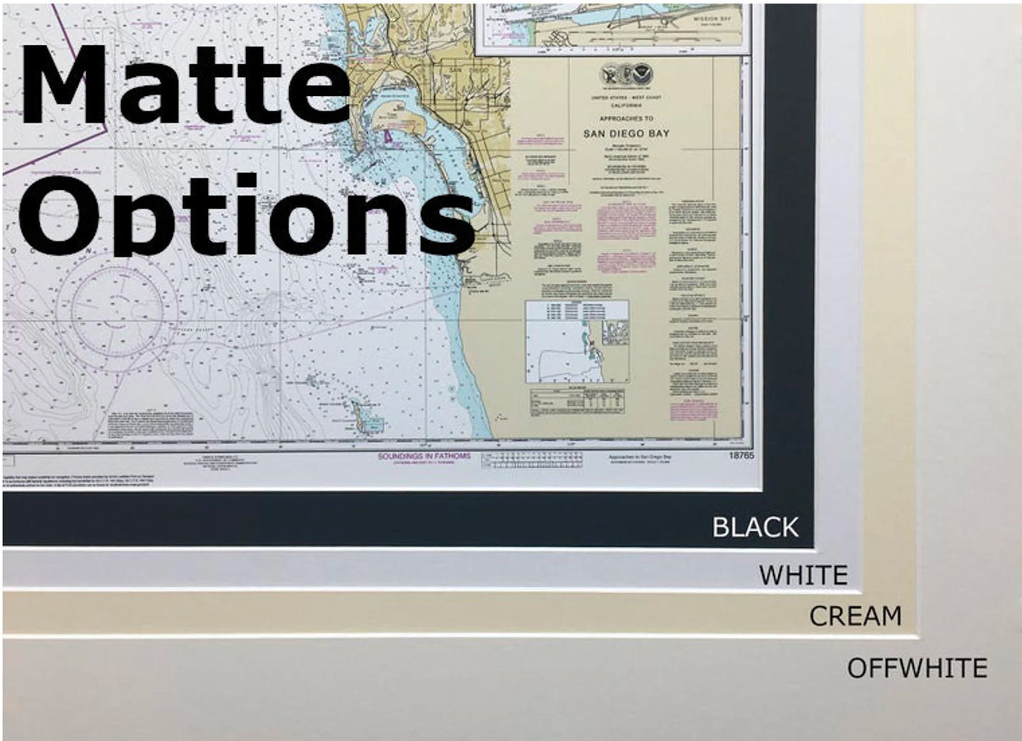
Each chart is meticulously handcrafted in the USA, showcasing exceptional craftsmanship and quality. It comes elegantly displayed in a solid wood frame, complemented by a museum-quality print crafted from archival paper and inks, ensuring its longevity and vibrancy. The chart is enhanced with a stylish black mat and protected by a clear glass front. The reverse side is finished with a paper duster for a polished look, and it includes a wire hanger for easy installation.
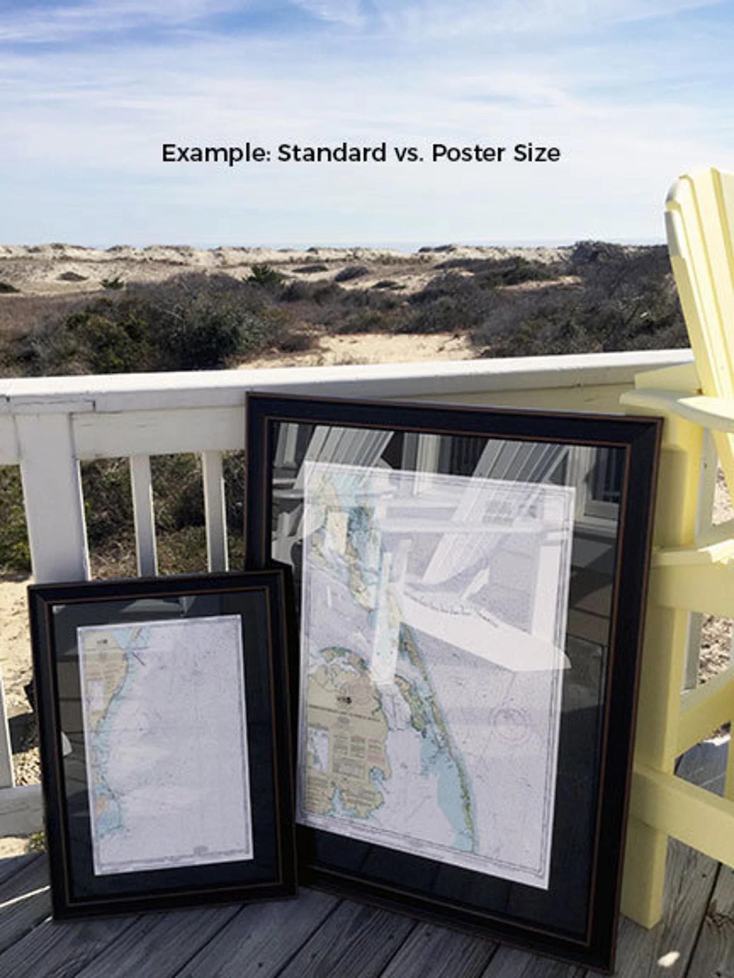
We offer two frame size options to suit your space:
- Standard size: outer frame dimensions of approximately 17 1/4" W x 24" H
- Poster size: outer frame dimensions of approximately 26" W x 36" H
If you're interested in a different frame style or size, please don’t hesitate to reach out to us with your preferences. We welcome any sample photos you may have to help us create your perfect piece.
*Important Shipping Note: Free ground shipping is available only for shipments to the 48 contiguous states. While we do not inflate our shipping costs, please contact us for a personalized shipping quote for orders to Alaska and Hawaii, as shipping costs may vary.
Share