Framed Nautical Charts
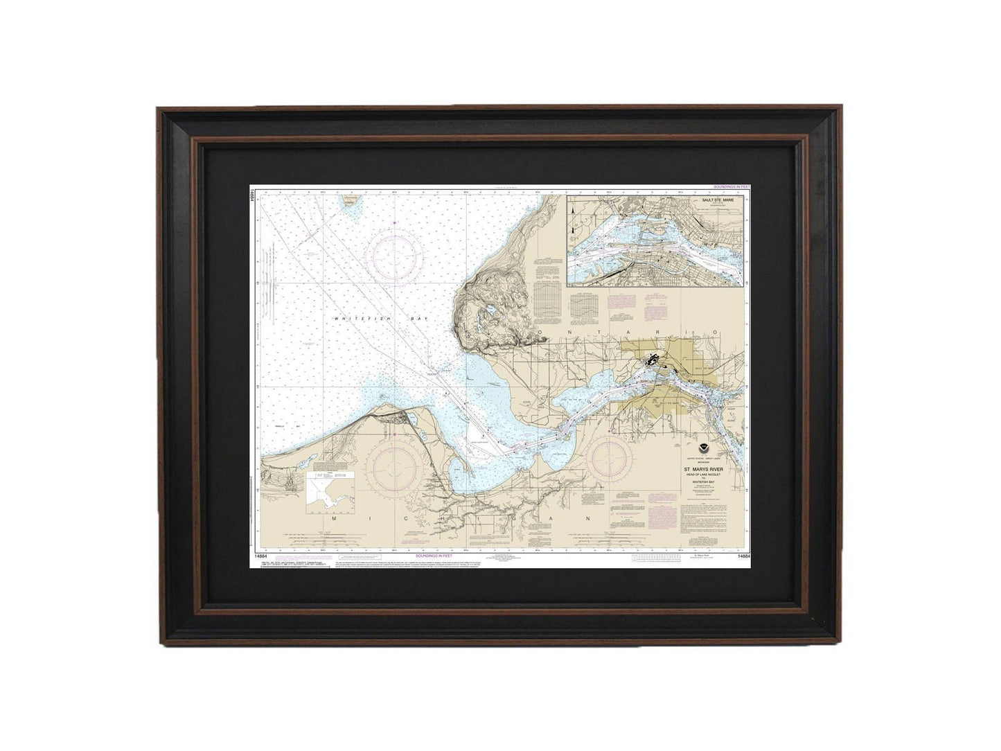
Framed Nautical Chart 14884 - Michigan's St. Marys River. NOAA 14884. Handmade in the USA.
Framed Nautical Chart 14884 - Michigan's St. Marys River. NOAA 14884. Handmade in the USA.
Couldn't load pickup availability
Discover the beauty of Michigan's St. Marys River with our expertly crafted Framed Nautical Map, spanning from the Head of Lake Nicolet to Whitefish Bay and Sault Ste. Marie. This official NOAA Nautical Chart captures the intricate details of these stunning waters, making it an ideal gift for boating enthusiasts and nature lovers alike.
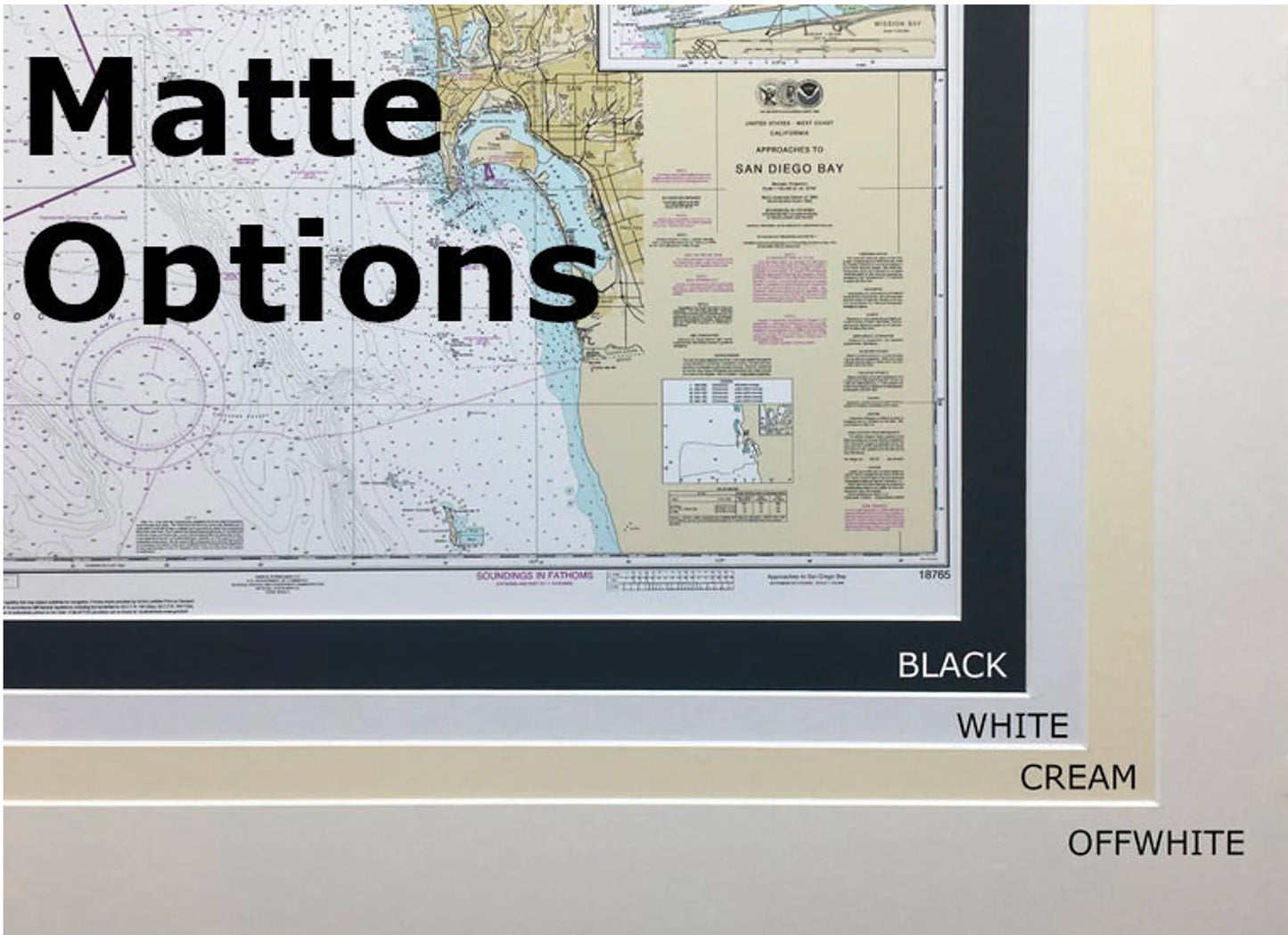
Each chart is custom handmade in the USA, showcasing exceptional craftsmanship. The nautical map is elegantly presented in a solid wood frame and is printed on museum-quality archival paper using high-quality inks to ensure longevity. It features a classic black mat and is protected by a durable glass front, allowing the vibrant details to shine through. The back is neatly finished with a paper duster, and a convenient wire hanger is included for effortless installation.
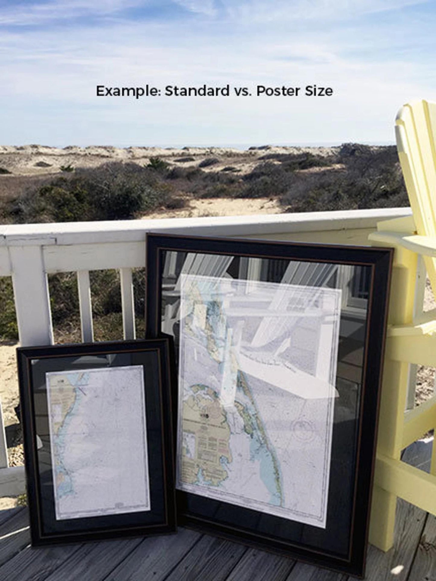
Available in two sizes to fit your space:
- Standard size: approximately 24" W x 18 1/4" H
- Poster size: approximately 36" W x 27 1/2" H
If you have a specific frame option in mind, please reach out—we would love to bring your vision to life. Feel free to share any sample photos that inspire you.
*Important Shipping Note: Free ground shipping is available for orders shipped within the 48 contiguous states. We do not inflate shipping costs; however, for shipments to Alaska and Hawaii, please contact us for a customized quote.
Share