Framed Nautical Charts
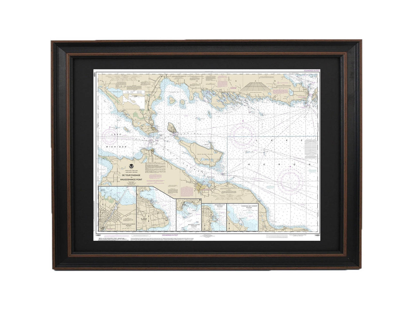
Framed Nautical Chart 14881 - Lake Huron, Detour Passage to Waugoshance Pt. NOAA 14881. Handmade in the USA.
Framed Nautical Chart 14881 - Lake Huron, Detour Passage to Waugoshance Pt. NOAA 14881. Handmade in the USA.
Couldn't load pickup availability
This beautifully framed nautical chart showcases the stunning waters of Lake Huron, spanning from Detour Passage to Waugoshance Point, and includes notable locations such as Hammond Bay Harbor, Mackinac Island, Cheboygan, Mackinaw City, and St. Ignace. Crafted with precision, this official NOAA Nautical Chart is not only a practical navigational tool but also a striking piece of art, handmade in the USA to ensure high standards of craftsmanship.
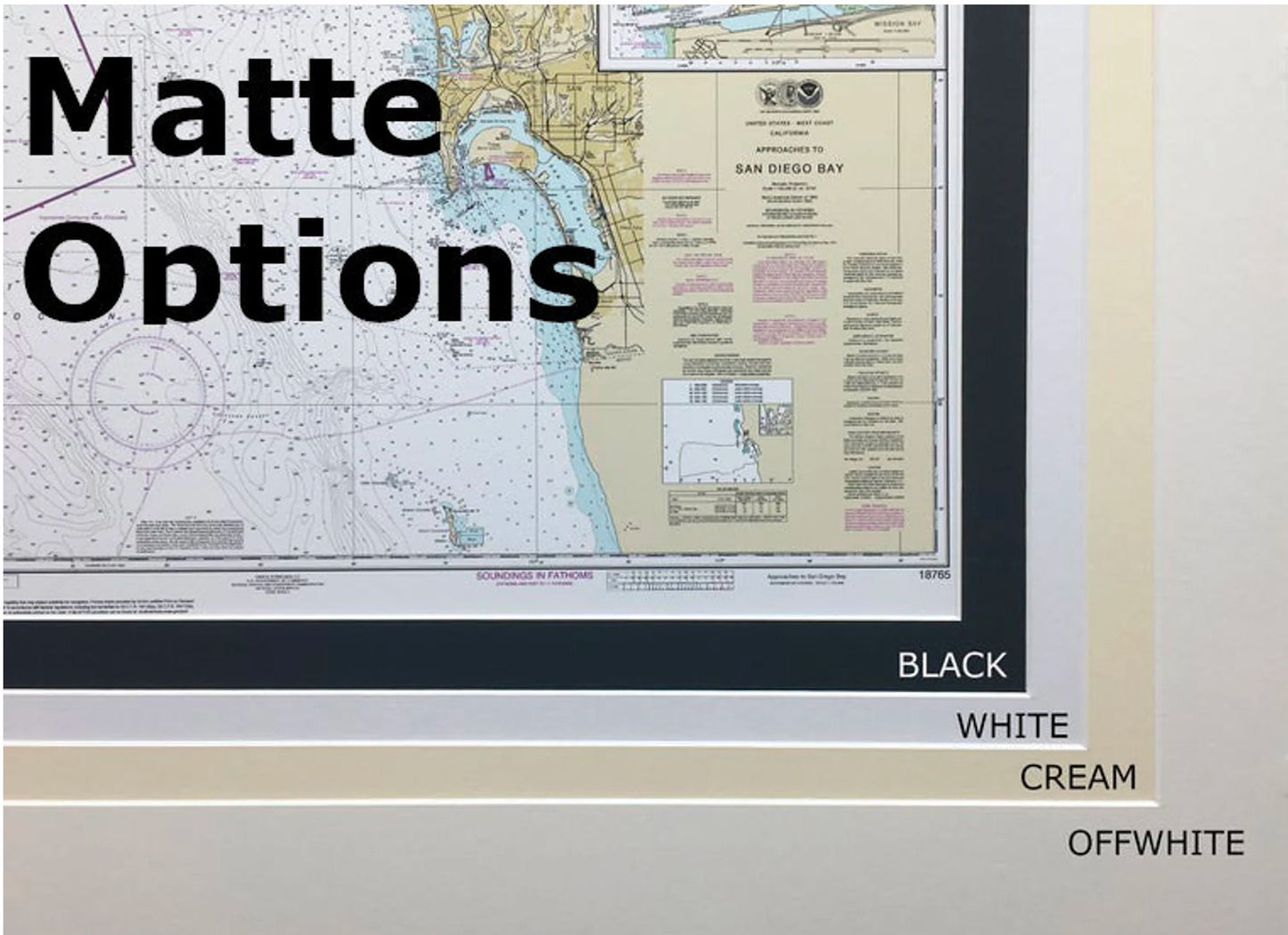
The chart is elegantly presented in a solid wood frame, featuring a museum-quality print made from archival paper and inks for long-lasting durability. It comes with a black mat and is protected by a sturdy glass front, adding a touch of sophistication to any space. The back of the frame is finished with a smooth paper duster, and a wire hanger is included for easy installation on your wall.
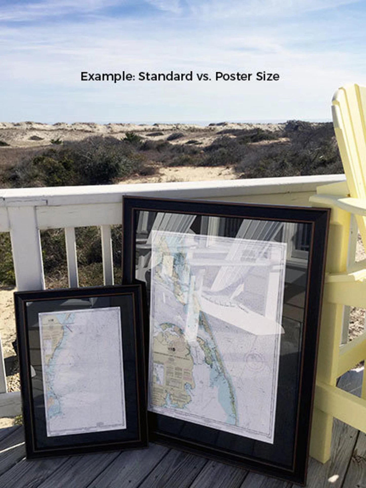
We offer this framed chart in two sizes:
- Standard size: Outer frame dimensions approximately 24" W x 18" H
- Poster size: Outer frame dimensions approximately 36" W x 27 1/4" H
If you have specific size or frame preferences in mind, please don’t hesitate to reach out with your request. We are more than happy to work with you to create the perfect framed chart that matches your vision.
*Important Shipping Note: We offer free ground shipping for orders within the 48 contiguous states. While we do not inflate shipping costs, please be aware that shipping to Alaska and Hawaii incurs higher fees. For custom shipping quotes to these states, please contact us directly.*
Share