Framed Nautical Charts
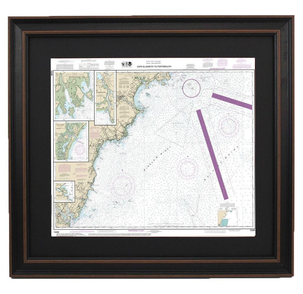
Framed Nautical Chart 13286 - Cape Elizabeth to Portsmouth. NOAA 13286. Handmade in the USA.
Framed Nautical Chart 13286 - Cape Elizabeth to Portsmouth. NOAA 13286. Handmade in the USA.
Couldn't load pickup availability
Discover the stunning beauty of Maine's coastline with our Framed Nautical Chart 13286, which intricately details the waterways from Cape Elizabeth to Portsmouth, including Cape Porpoise Harbor, Wells Harbor, Kennebunk River, and Perkins Cove. This official NOAA Nautical Chart is meticulously handmade in the USA, showcasing exceptional craftsmanship and attention to detail.
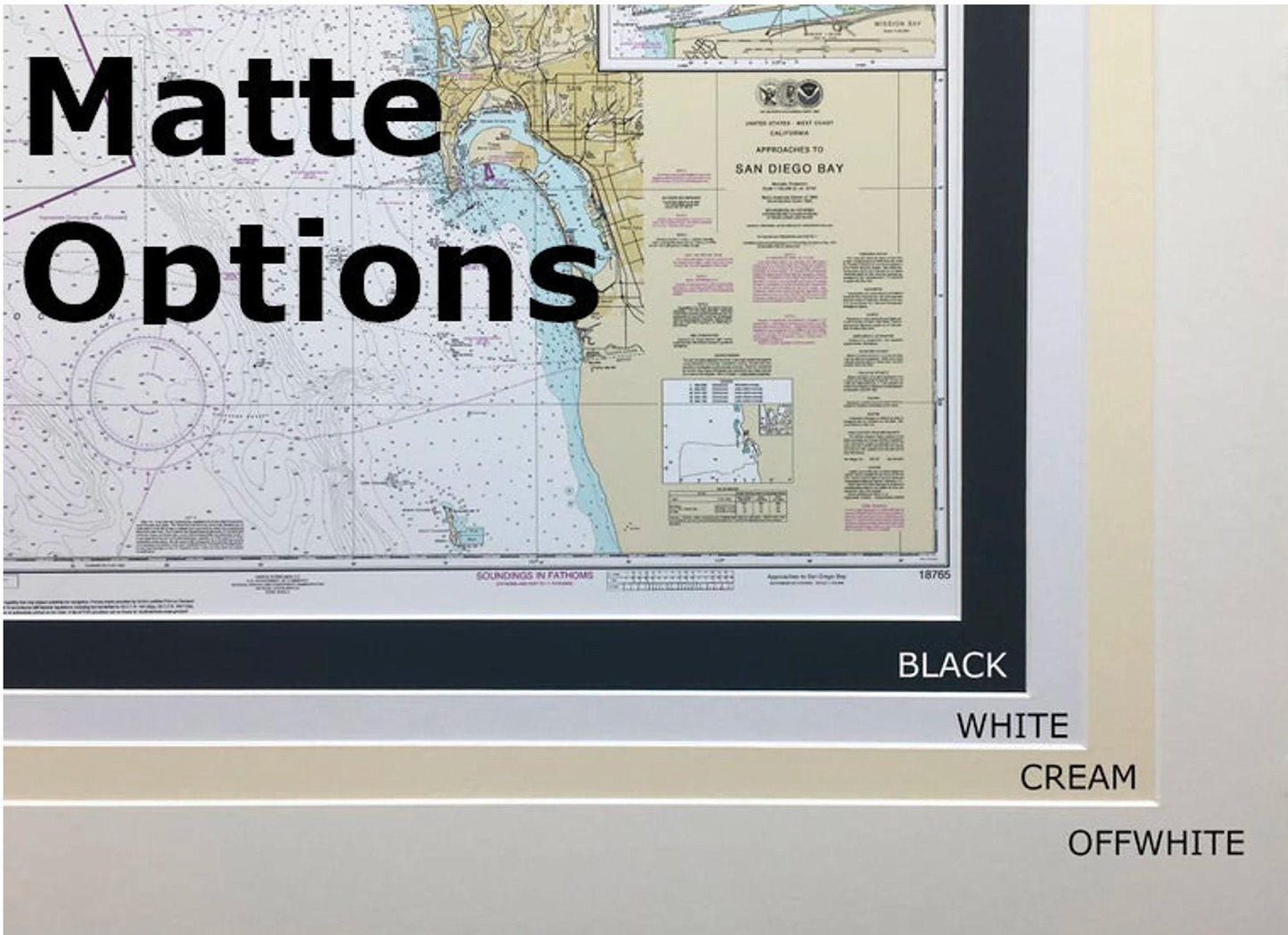
Each chart is elegantly presented in a solid wood frame and features a museum-quality print crafted from archival paper and inks for long-lasting vibrancy. The design includes a complementary black mat and is protected by a glass front, ensuring durability and visual appeal. The back is neatly finished with a paper duster, and we provide a convenient wire hanger for easy installation.
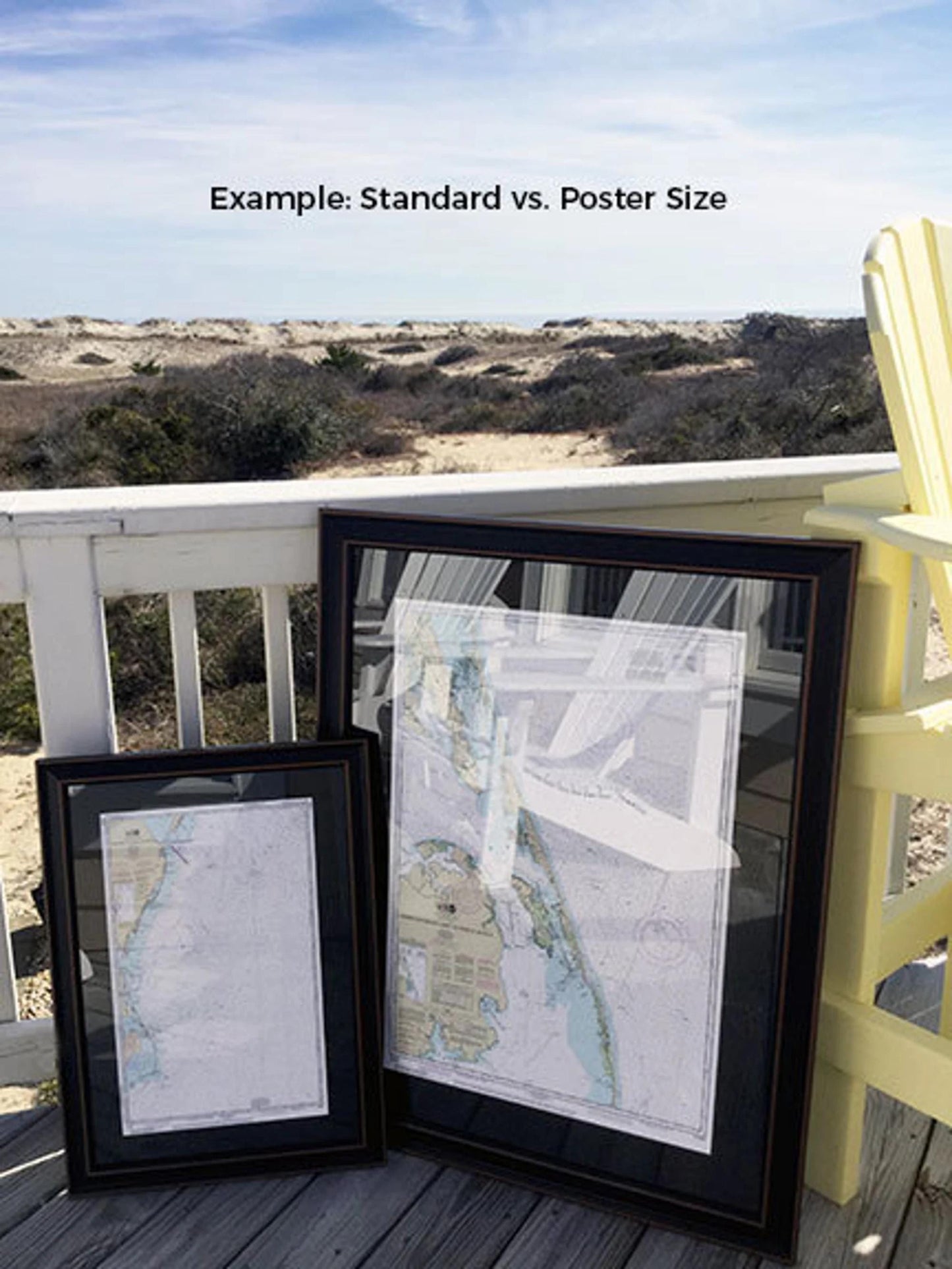
Our framed charts are available in two sizes:
- Standard size: Outer frame dimensions approximately 24" W x 20" H
- Poster size: Outer frame dimensions approximately 36" W x 30" H
If you have a specific vision or different frame option in mind, please don’t hesitate to reach out to us. We are more than happy to work with you, and feel free to share any sample photos that can help us bring your idea to life.
*Important Shipping Note: We offer free ground shipping for deliveries to the 48 contiguous states. While we aim to provide transparent shipping costs, please contact us for custom shipping quotes for Alaska and Hawaii, as additional charges may apply. Experience the charm of Maine's maritime history with this exquisite framed nautical chart, perfect for any coastal enthusiast or as a unique gift.
Share