Framed Nautical Charts
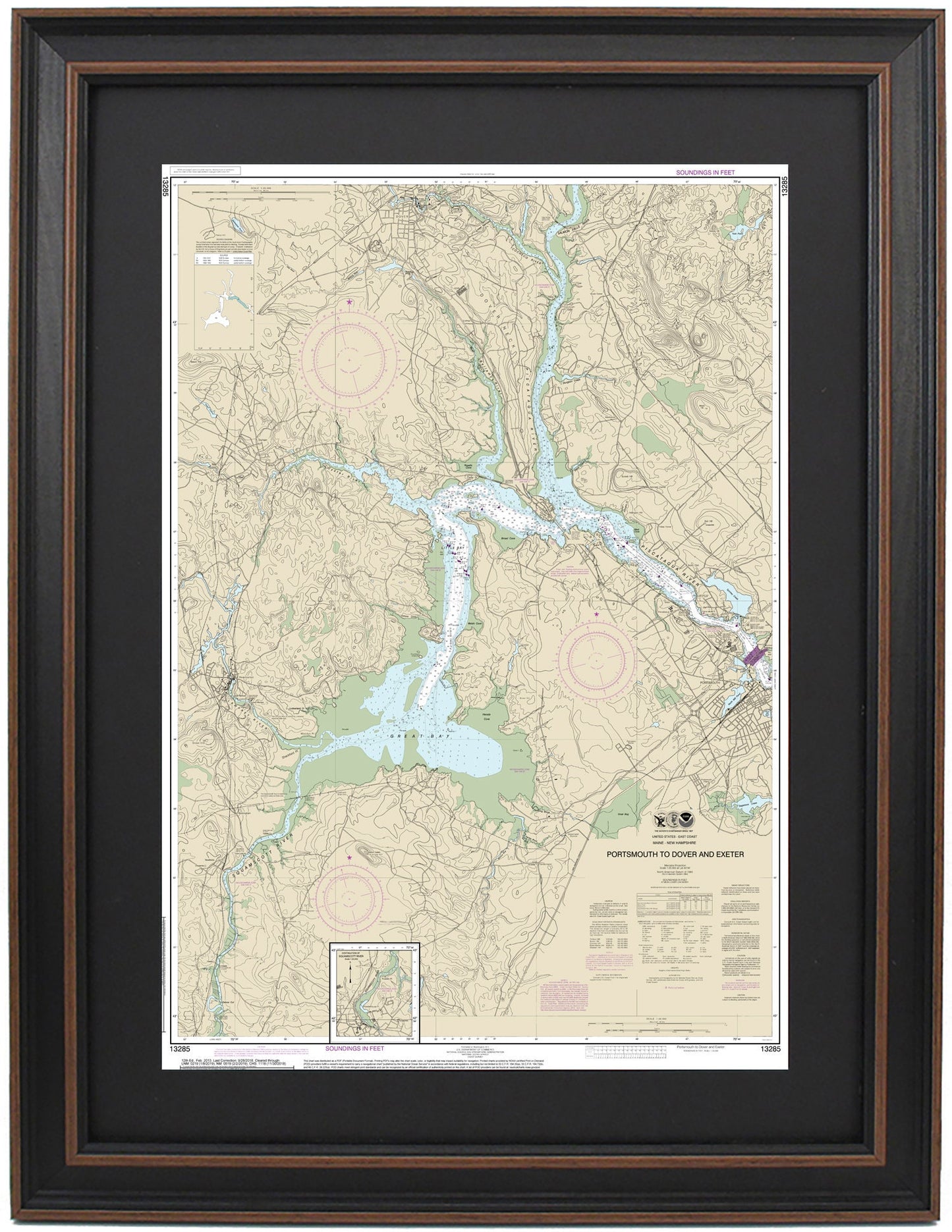
Framed Nautical Chart 13285 - Portsmouth to Dover and Exeter. NOAA 13285. Handmade in the USA.
Framed Nautical Chart 13285 - Portsmouth to Dover and Exeter. NOAA 13285. Handmade in the USA.
Couldn't load pickup availability
Experience the charm of coastal New England with our beautifully crafted Framed Nautical Chart, featuring the stunning waters that stretch from Portsmouth to Dover and Exeter, NH (NOAA Chart 13285). This officially licensed NOAA Nautical Chart offers intricate details about the region’s waterways and riverbanks, highlighting areas such as the Piscataqua River, Little Bay, Great Bay, and neighboring towns.
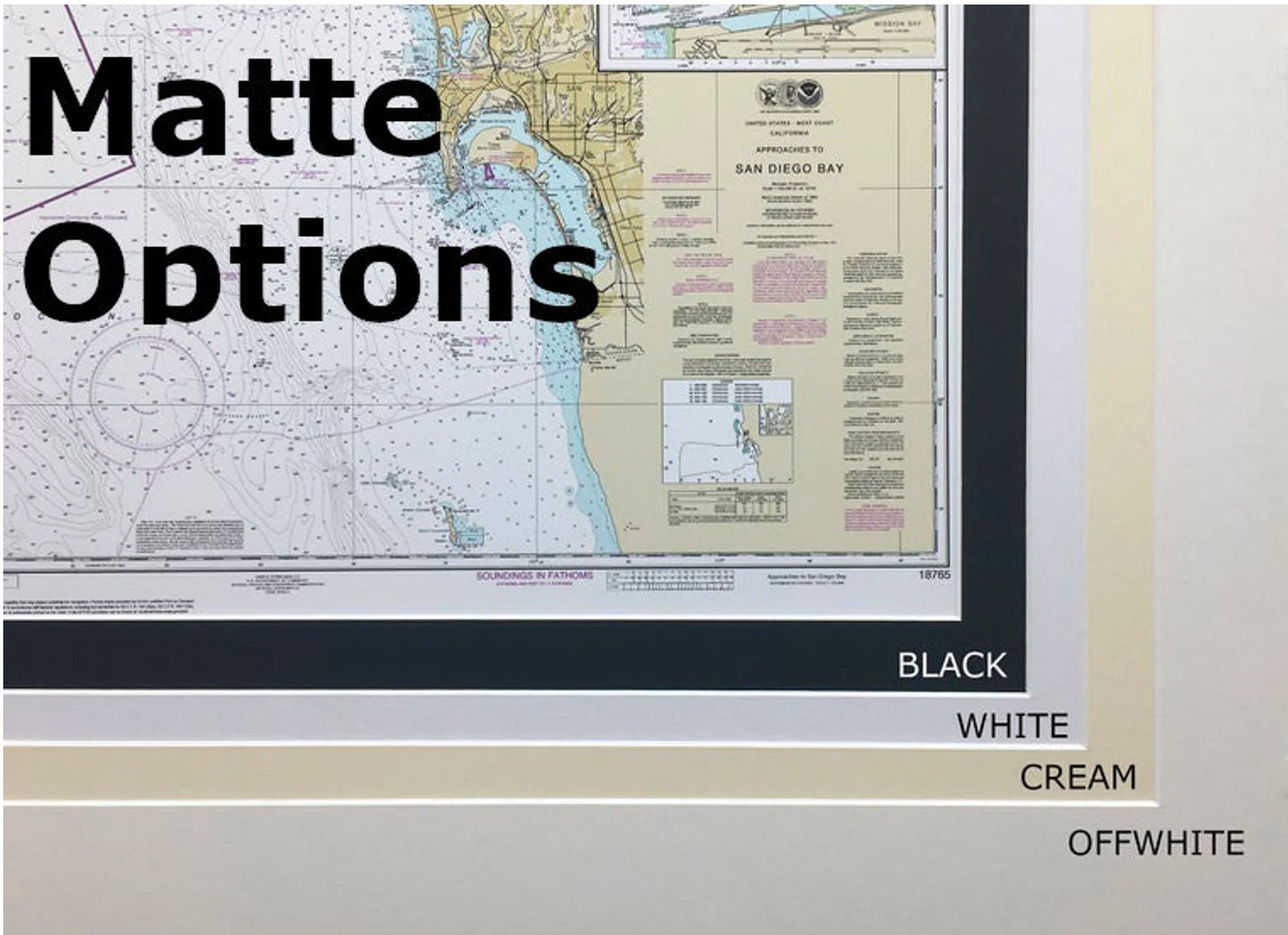
Each chart is carefully handmade in the USA, reflecting our commitment to exceptional craftsmanship. It comes elegantly presented in a solid wood frame, showcasing a museum-quality print made from archival-grade paper and inks. The design is enhanced with a sophisticated black mat and protected by glass, ensuring both durability and aesthetic appeal. The back is finished with a paper duster for a refined look, and a convenient wire hanger is included for straightforward installation.
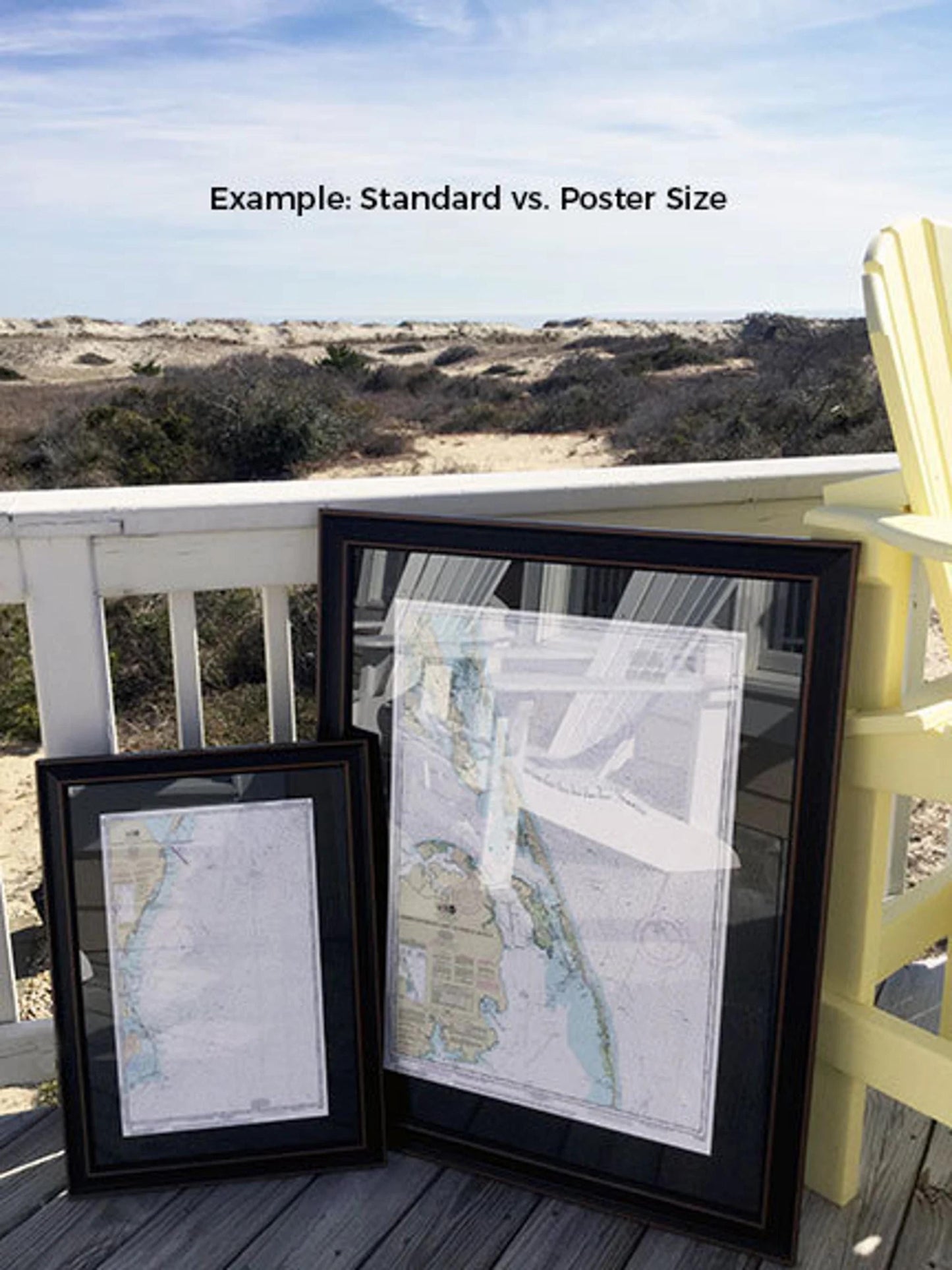
You can choose between two frame sizes:
-standard size with outer dimensions of approximately 16 3/4" W x 24" H
-poster size measuring approximately 25" W x 36" H
If you desire a different frame option, please don’t hesitate to contact us with your request. We also encourage you to share any sample photos to help us bring your vision to life.
*Important Shipping Note: We offer free ground shipping for deliveries within the 48 contiguous states. We do not inflate our shipping costs; however, for shipments to Alaska and Hawaii, please reach out for a custom shipping quote.
Share