Framed Nautical Charts
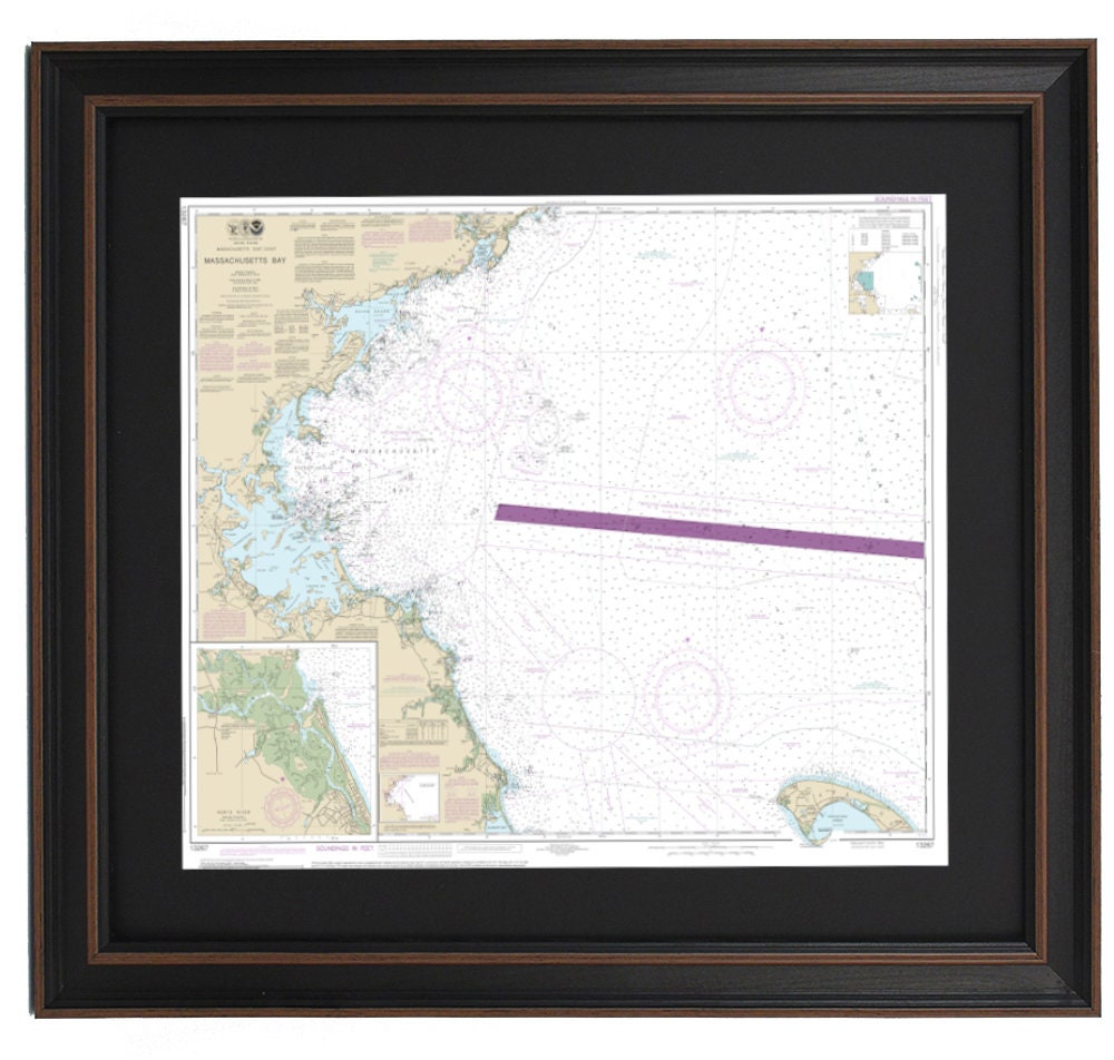
Framed Nautical Chart 13267 - Massachusetts Bay. North River. NOAA 13267. Handmade in the USA.
Framed Nautical Chart 13267 - Massachusetts Bay. North River. NOAA 13267. Handmade in the USA.
Couldn't load pickup availability
Discover the beauty of Eastern Massachusetts with this exquisite Framed Nautical Map, officially sourced from NOAA Chart 13267. This detailed chart captures the stunning waters and coastline of Massachusetts Bay, North River, Dorchester Bay, Broad Sound, Salem Sound, Salem Harbor, Gloucester Harbor, and numerous charming towns and harbors. Each map is meticulously handcrafted in the USA, reflecting exceptional craftsmanship and quality.
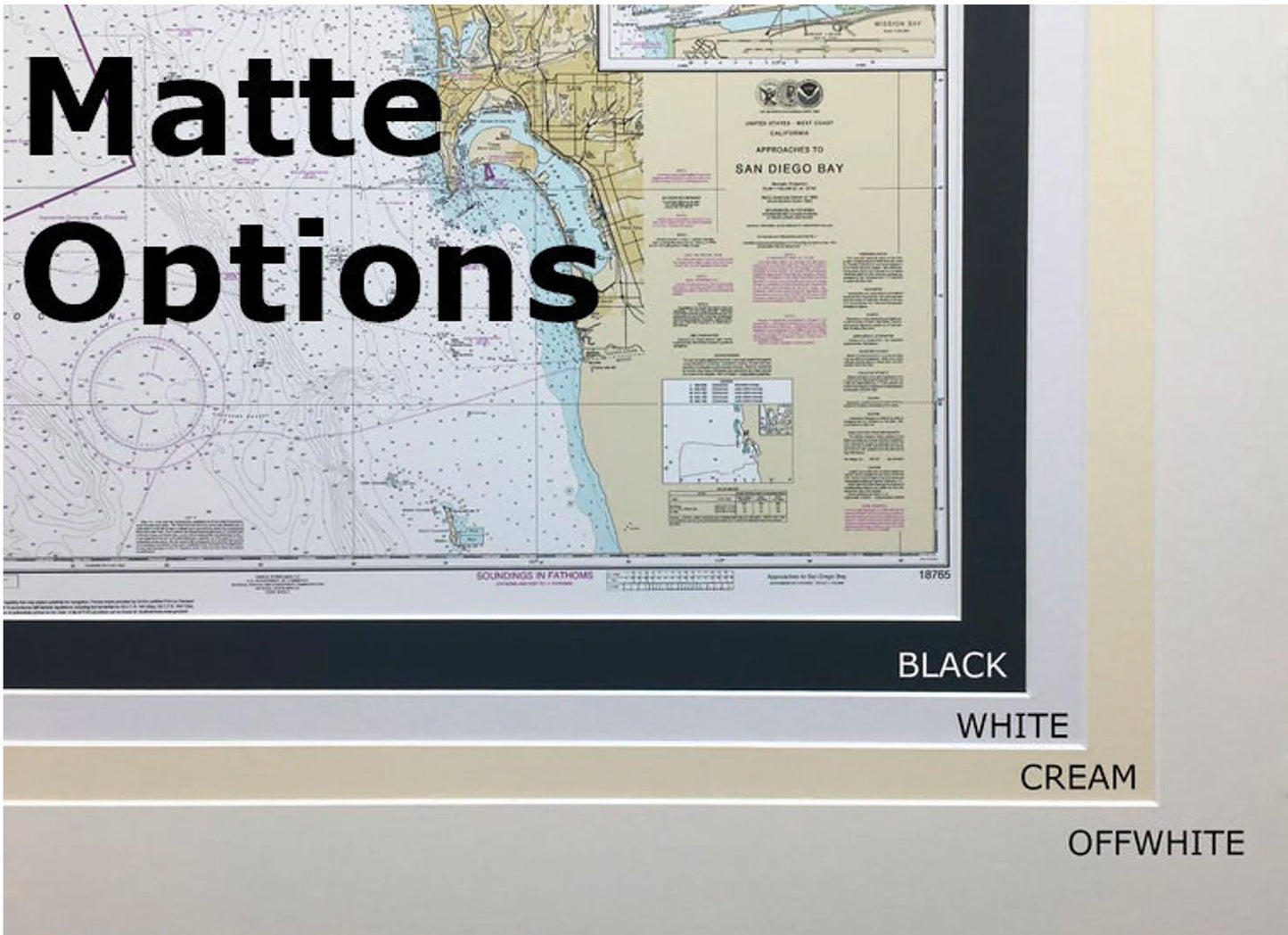
The nautical chart is elegantly presented in a solid wood frame and features a museum-quality print created with archival paper and inks, ensuring both durability and vivid detail. The artwork is enhanced with a classic black mat and protected by a glass front, making it a stunning addition to your home or office decor. The back of the frame is finished with a paper duster, and a convenient wire hanger is included for effortless installation.
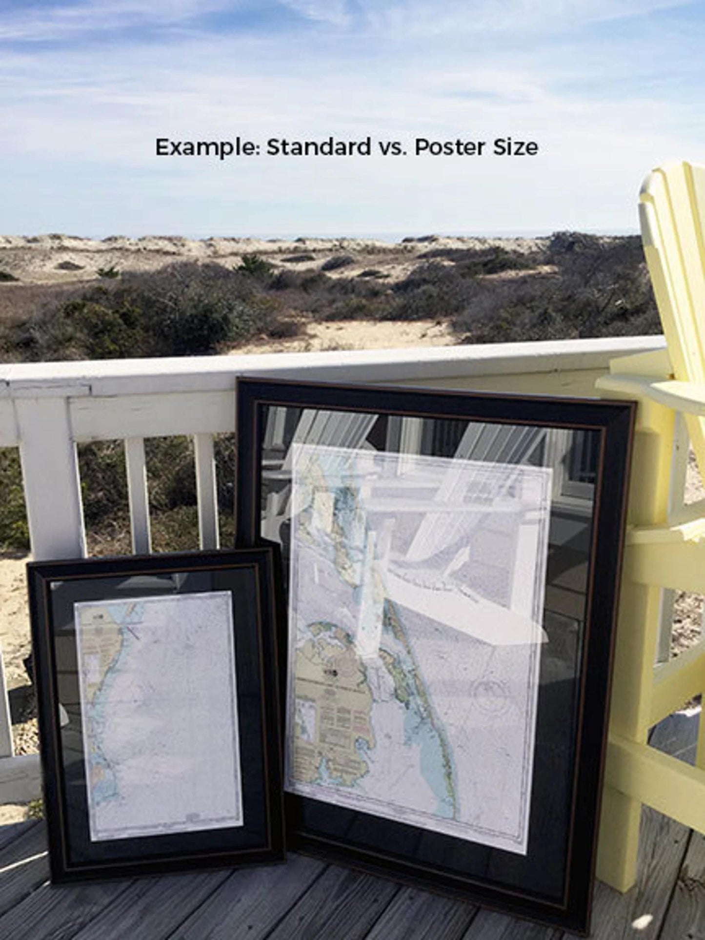
This framed chart is available in two sizes:
- Standard Size: Approximately 19" H x 24" W
- Poster Size: Approximately 28 1/2” H x 36" W
If you are looking for a different framing option, please don’t hesitate to reach out with your specific requests. We are happy to work with you to create the perfect piece that aligns with your vision, and we welcome any sample photos you may have.
**Important Shipping Information:** Free ground shipping is available for deliveries to the 48 contiguous states. We do not inflate shipping costs; however, due to the higher shipping expenses to Alaska and Hawaii, please contact us for a custom shipping quote. Enhance your space with this striking representation of East Coast maritime heritage!
Share