Framed Nautical Charts
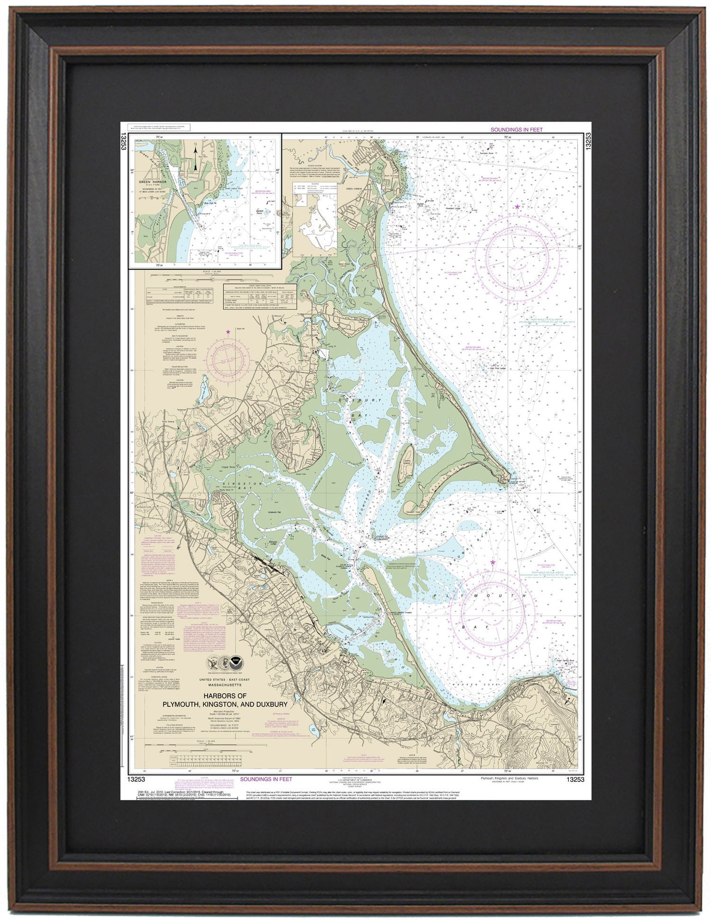
Framed Nautical Chart 13253 - Harbors of Plymouth, Kingston, and Duxbury. NOAA 13253. Handmade in the USA.
Framed Nautical Chart 13253 - Harbors of Plymouth, Kingston, and Duxbury. NOAA 13253. Handmade in the USA.
Couldn't load pickup availability
Discover the stunning beauty of the Harbors of Plymouth, Kingston, and Duxbury with this finely crafted Framed Nautical Chart, NOAA 13253. This official NOAA Nautical Chart captures the essence of the region's picturesque waters and coastlines, showcasing landmarks such as Plymouth Rock, Plymouth Bay, Plymouth Harbor, Kingston Bay, and various nearby towns and harbors.
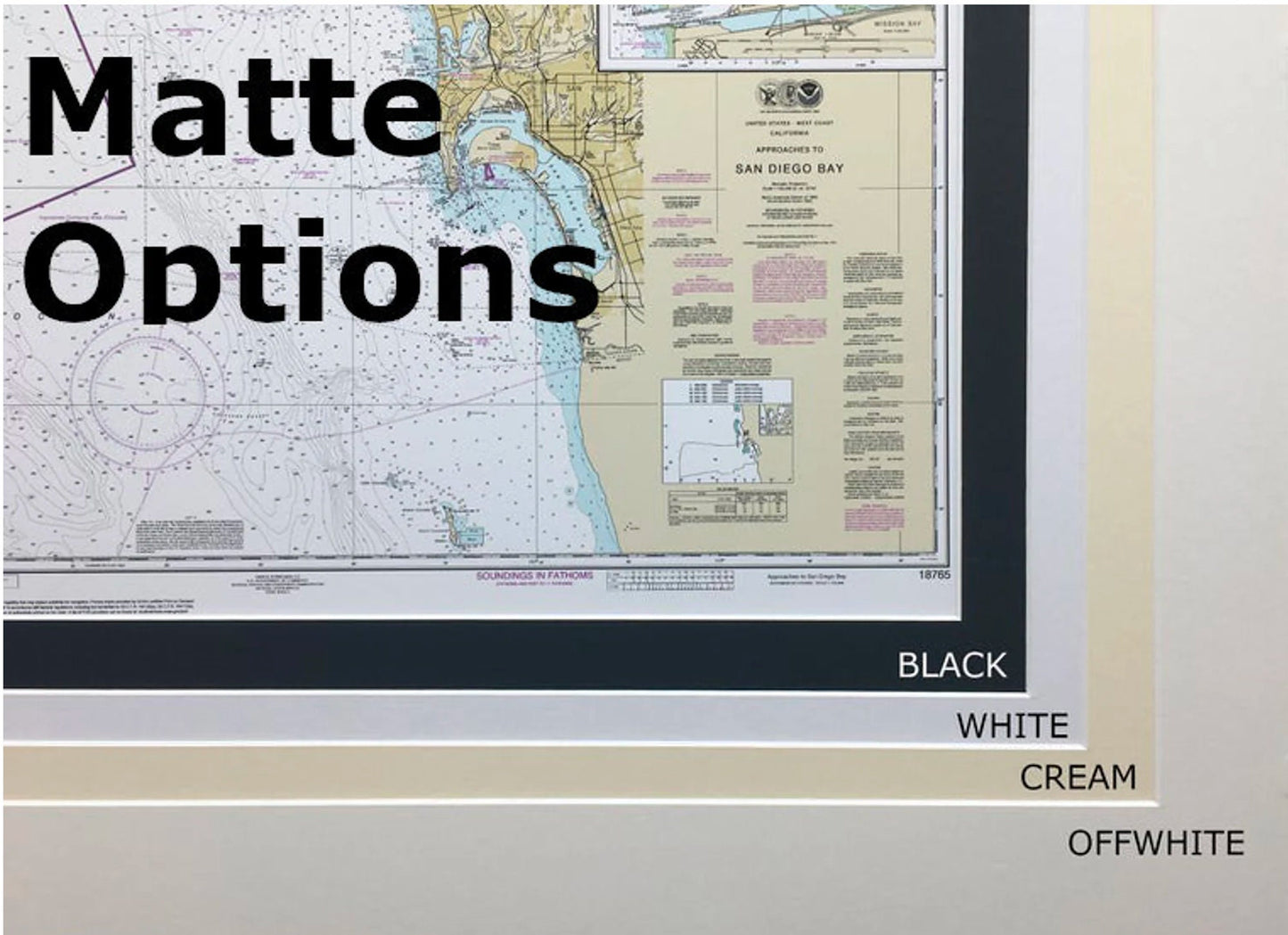
Each nautical map is meticulously handmade in the USA, exemplifying exceptional craftsmanship and attention to detail. This chart is elegantly presented in a solid wood frame, featuring a museum-quality print created from archival paper and inks for long-lasting durability. It also includes a stylish black mat and is protected by a glass front for a polished finish. The back is thoughtfully finished with a paper duster, and a wire hanger is provided for easy installation.
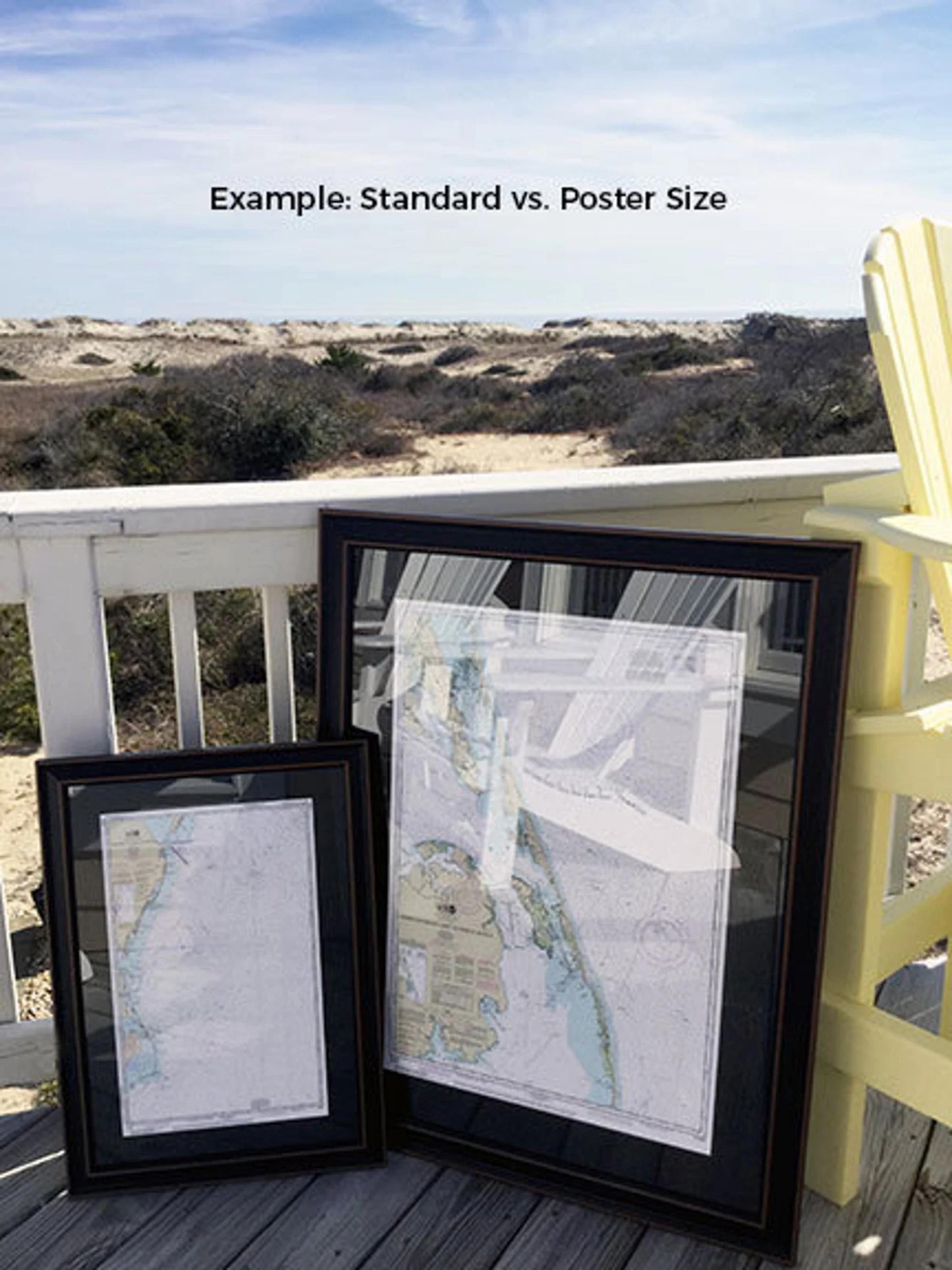
Available in two sizes:
-standard size features outer frame dimensions of approximately 16 3/4" W x 24" H
-poster size features outer frame dimensions of approximately 1 25 1/4" W x 36" H
If you’re seeking a custom framing option, we encourage you to reach out with your ideas. We are happy to work with any sample photos you provide to help bring your vision to life.
*Important Shipping Note: Free ground shipping is available for deliveries within the 48 contiguous states. While we do not inflate shipping costs, please contact us for custom shipping quotes if you are located in Alaska or Hawaii due to the higher shipping rates.
Share