Framed Nautical Charts
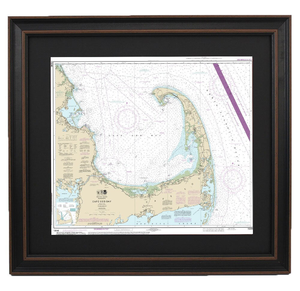
Framed Nautical Chart 13246 - Cape Cod Bay. NOAA 13246. Handmade in the USA.
Framed Nautical Chart 13246 - Cape Cod Bay. NOAA 13246. Handmade in the USA.
Couldn't load pickup availability
Discover the beauty of Cape Cod with this exquisite Framed Nautical Chart 13246, showcasing the stunning waters of Cape Cod Bay. Officially produced by NOAA, this nautical map captures the intricate details of this iconic Massachusetts coastline. Each chart is meticulously handcrafted in the USA, ensuring exceptional quality and craftsmanship.
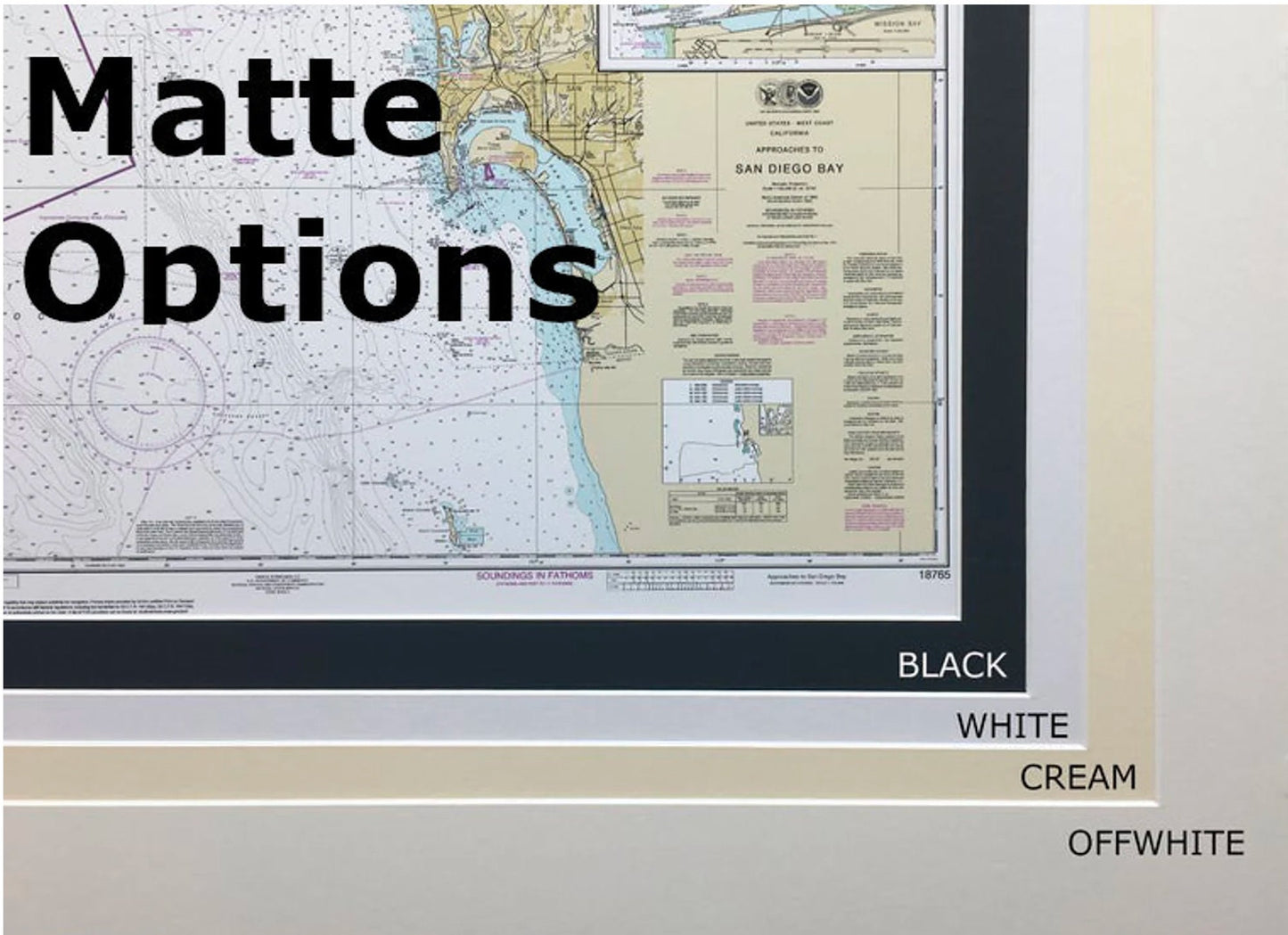
The map is elegantly presented in a solid wood frame and features a museum-quality print created with archival paper and inks for lasting vibrancy. Enhanced by a sleek black mat, the chart is protected by a glass front, making it a perfect addition to any nautical-themed decor. The back is finished with a paper duster, and it includes a convenient wire hanger for effortless installation.
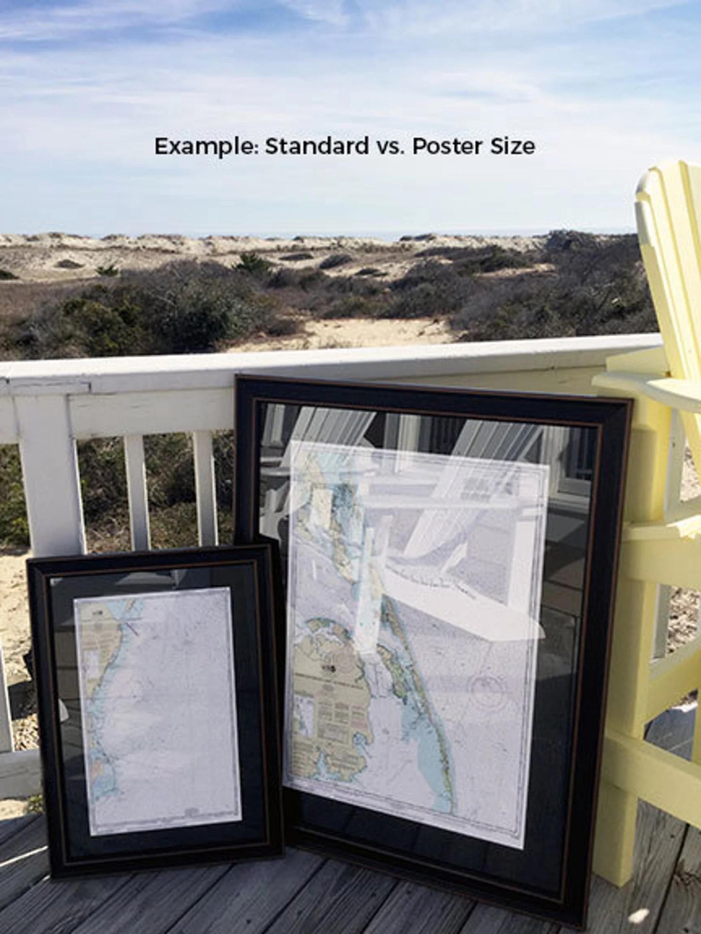
Available in two sizes for your preference:
- Standard Size: Outer frame dimensions of approximately 24" W x 19 3/4" H
- Poster Size: Outer frame dimensions of approximately 36" W x 29 1/2" H
If you have a specific frame option in mind, feel free to reach out to us with your request. We’d love to collaborate with you and create exactly what you envision, and we welcome sample photos to assist in the design process.
*Important Shipping Note: Free ground shipping is available only for deliveries within the 48 contiguous states. While we do not inflate shipping costs, please contact us for a custom shipping quote if you're located in Alaska or Hawaii due to higher shipping fees.
Share