Framed Nautical Charts
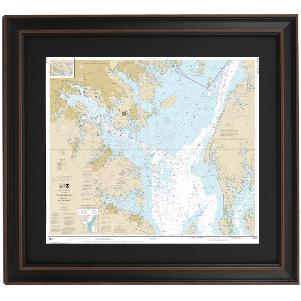
Framed Nautical Chart 12278 - Chesapeake Bay Approaches to Baltimore Harbor, NOAA 12278. Handmade in the USA.
Framed Nautical Chart 12278 - Chesapeake Bay Approaches to Baltimore Harbor, NOAA 12278. Handmade in the USA.
Couldn't load pickup availability
Discover the stunning beauty of the Chesapeake Bay with this framed nautical chart, specifically designed to showcase the approaches to Baltimore Harbor. This official NOAA 12278 Nautical Chart intricately details the picturesque waterways of the Chesapeake Bay, making it a perfect addition to any maritime enthusiast's collection.
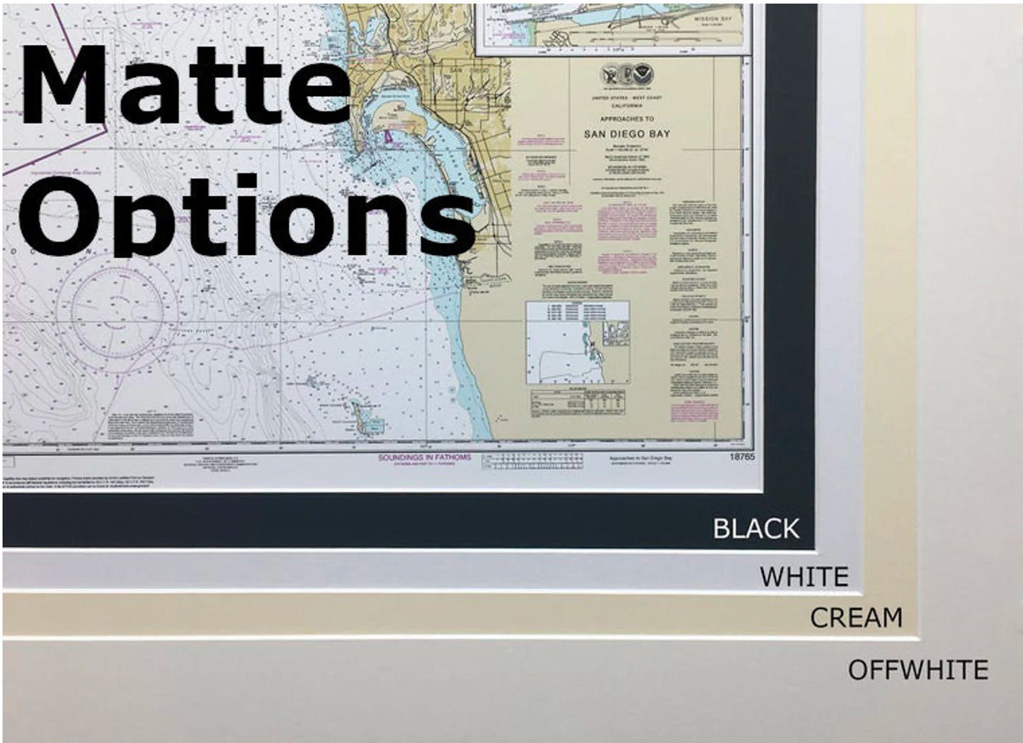
Each chart is meticulously handcrafted in the USA, reflecting exceptional craftsmanship and attention to detail. The chart comes elegantly presented in a solid wood frame and features a museum-quality print produced on archival paper with durable inks. To enhance its aesthetic appeal, a black mat complements the chart, while a protective glass front ensures its longevity.
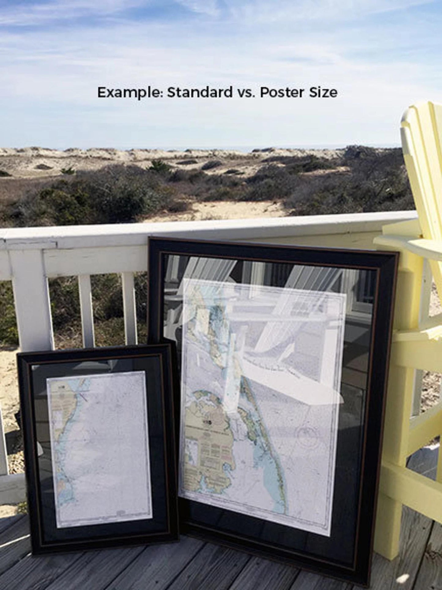
The reverse side is finished with a paper duster for a polished look, and a wire hanger is included for easy installation on your wall. Choose from two frame sizes to suit your space:
- Standard size: approximately 24" W x 20 3/4" H
- Poster size: approximately 36" W x 31" H
If you're interested in a custom frame option, please feel free to reach out with your specific requests. We also welcome any sample photos you may have to help us create the perfect presentation that matches your vision.
*Important Shipping Note: We offer free ground shipping within the 48 contiguous states. While we do not mark up any shipping costs, please contact us for custom shipping quotes if you reside in Alaska or Hawaii due to the higher shipping expenses.
Share