Framed Nautical Charts
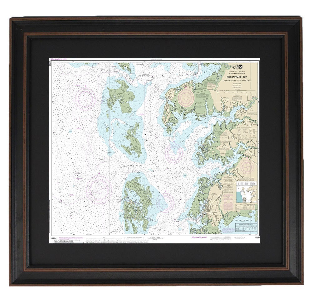
Framed Nautical Chart 12231 - Chesapeake Bay, Northern Tangier Sound, NOAA 12231. Handmade in the USA.
Framed Nautical Chart 12231 - Chesapeake Bay, Northern Tangier Sound, NOAA 12231. Handmade in the USA.
Couldn't load pickup availability
Discover the exquisite Framed Nautical Chart featuring Chesapeake Bay and Northern Tangier Sound, officially produced by NOAA. This meticulously crafted map captures the stunning waterways of the Chesapeake Bay, making it a perfect addition to any coastal-themed decor. Each chart is custom handmade in the USA, showcasing high standards of craftsmanship that highlight the intricate details of these beautiful regions.
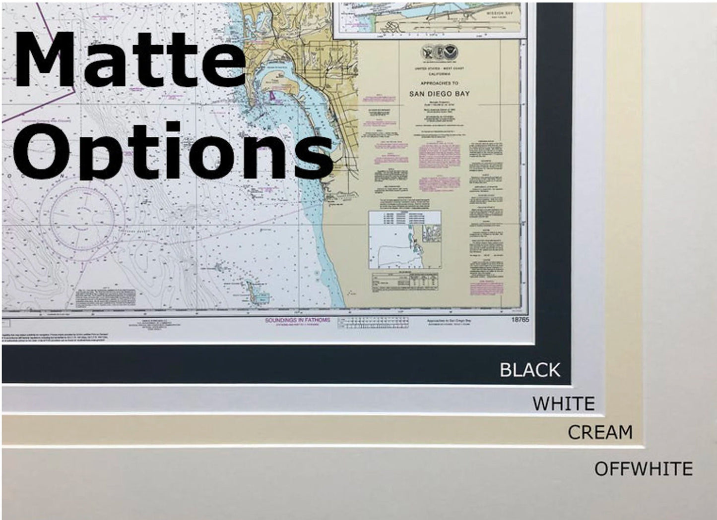
The nautical chart is elegantly displayed in a solid wood frame and features a museum-quality print made from archival paper and inks, ensuring durability and vibrant colors. The design is complemented by a black mat and protected by a glass front, providing not only an aesthetic appeal but also safeguarding the chart for years to come. The back is finished with a paper duster for a polished look, and a wire hanger is included for easy installation.
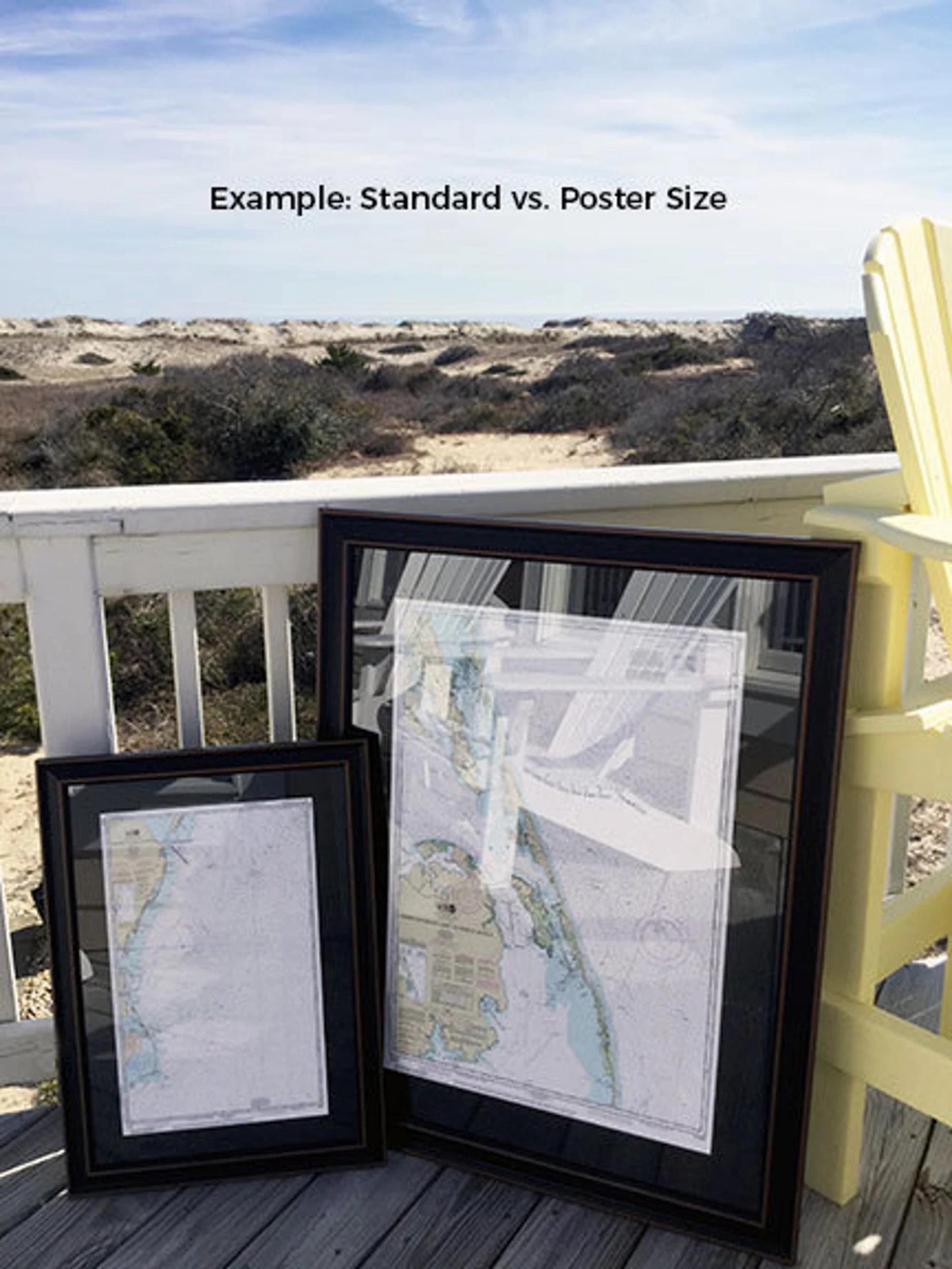
Frames are available in two sizes:
- Standard size: Outer frame dimensions approximately 24" W x 19 1/4" H
- Poster size: Outer frame dimensions approximately 36" W x 28 3/4" H
If you're interested in a different frame option, please feel free to reach out with your request. We are happy to collaborate with you and welcome any sample photos that will help us create exactly what you envision.
*Important Shipping Note: Free ground shipping is available for shipments to the 48 contiguous states. While we do not mark up additional shipping costs, please note that shipping to Alaska and Hawaii may incur higher expenses. Contact us for custom shipping quotes tailored to your location.
Share