Framed Nautical Charts
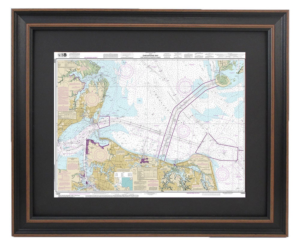
Framed Nautical Chart 12222 - Chesapeake Bay, Cape Charles to Norfolk Harbor, NOAA 12222. Handmade in the USA.
Framed Nautical Chart 12222 - Chesapeake Bay, Cape Charles to Norfolk Harbor, NOAA 12222. Handmade in the USA.
Couldn't load pickup availability
Discover the beauty of Chesapeake Bay with our meticulously crafted Framed Nautical Chart, showcasing the stunning waterways from Cape Charles to Norfolk Harbor, VA. This official NOAA Nautical Chart is not only a functional navigational tool, but also a striking piece of art, custom handmade in the USA with exceptional craftsmanship.
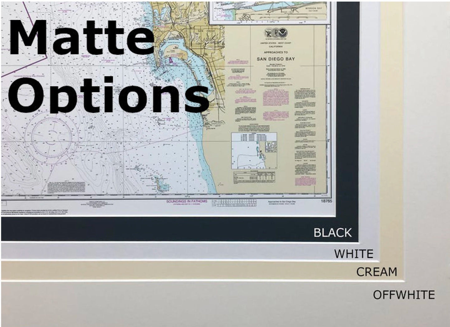
The chart is elegantly presented in a solid wood frame, featuring a museum-quality print created from archival paper and inks to ensure lasting vibrancy and detail. It includes a sophisticated black mat and is protected by a durable glass front, ensuring your chart remains in pristine condition. The back is finished with a paper duster for a refined look and comes equipped with a wire hanger for easy installation.
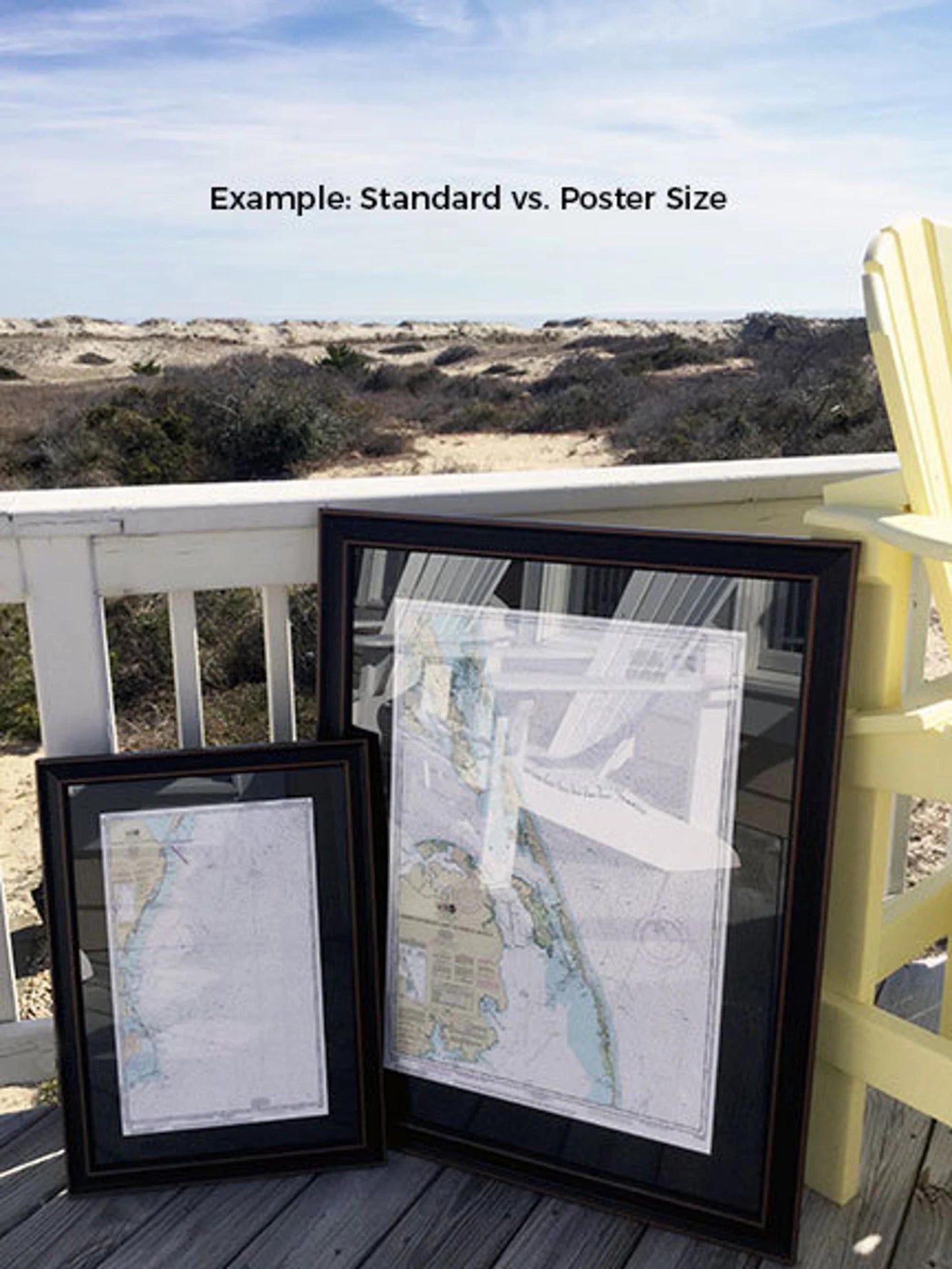
Our framed nautical charts are available in two sizes to suit your preferences:
- Standard size: outer frame dimensions approximately 24" W x 18.5" H
- Poster size: outer frame dimensions approximately 36" W x 27.75" H
If you have a specific frame option in mind, please feel free to reach out with your request. We’re happy to work with you to create a personalized look that matches your vision.
*Important Shipping Note: We offer free ground shipping for orders within the 48 contiguous states. While we do not inflate shipping costs, please contact us for a custom shipping quote if you are located in Alaska or Hawaii, as these areas have higher shipping fees. Elevate your space with this exquisite nautical chart and celebrate the charm of Chesapeake Bay!
Share