Framed Nautical Charts
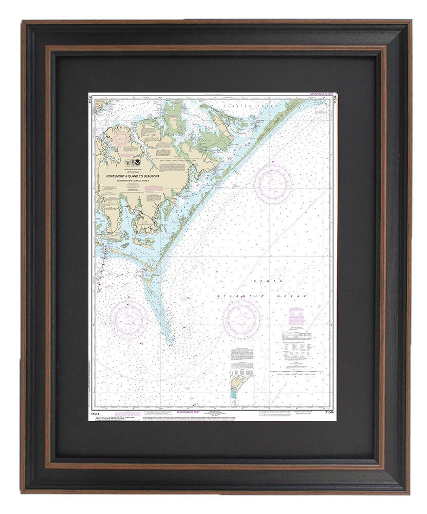
Framed Nautical Chart 11544 - Outer Banks - Portsmouth Island to Beaufort & Cape Lookout. NOAA 11544. Handmade in the USA.
Framed Nautical Chart 11544 - Outer Banks - Portsmouth Island to Beaufort & Cape Lookout. NOAA 11544. Handmade in the USA.
Couldn't load pickup availability
Discover the beauty of the Outer Banks with our handcrafted Framed Nautical Chart, which details the stunning waterways from Portsmouth Island to Beaufort, NC. This official NOAA Nautical Chart provides essential navigational information for seafarers and nature enthusiasts alike, showcasing the picturesque coastal region of North Carolina.
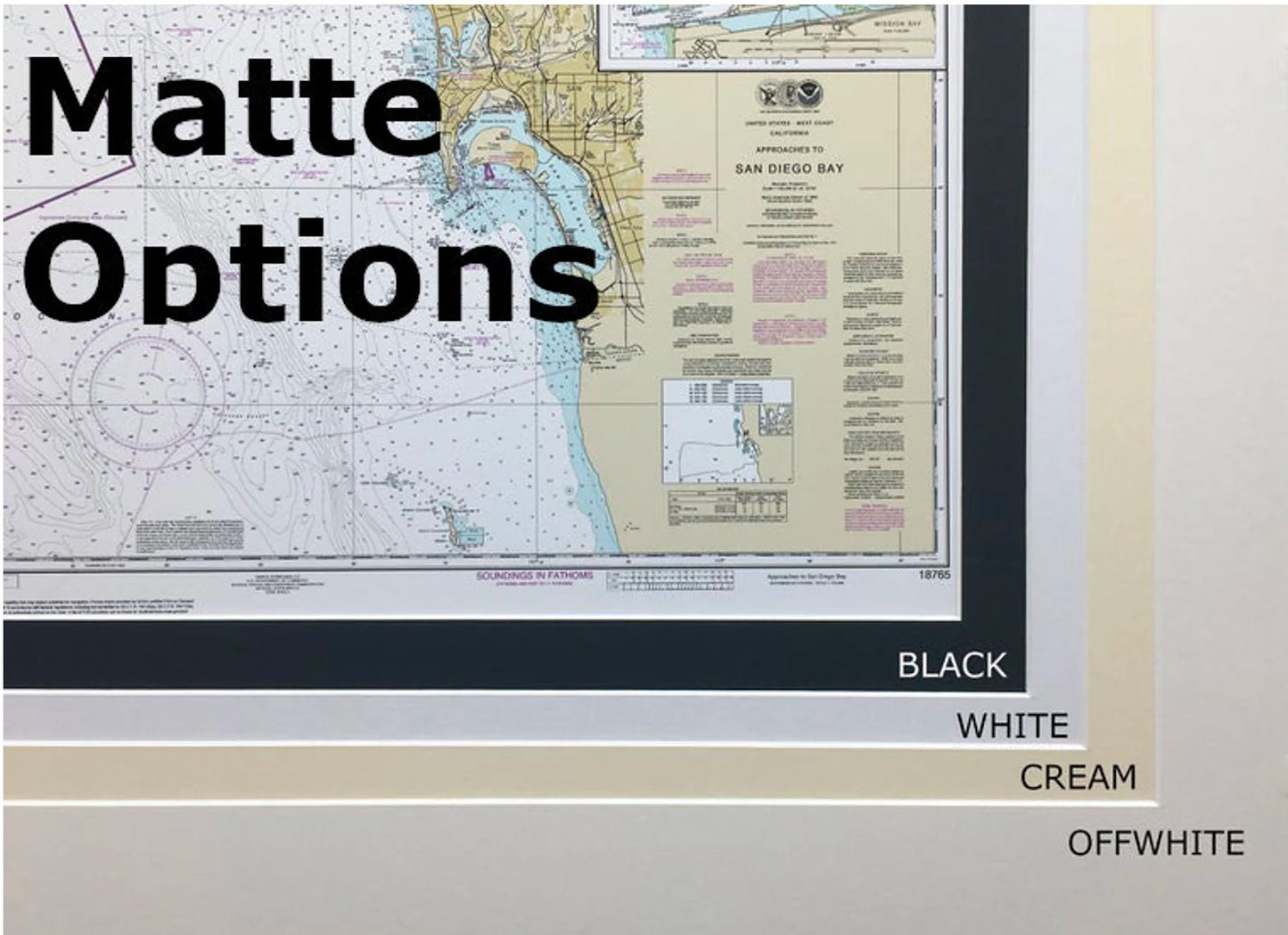
Each chart is meticulously handmade in the USA, reflecting exceptional craftsmanship and attention to detail. It is beautifully presented in a solid wood frame, featuring a museum-quality print on archival paper using fade-resistant inks. To enhance its elegance, the chart is complemented by a black mat and protected by a glass front, ensuring its longevity and visual appeal.
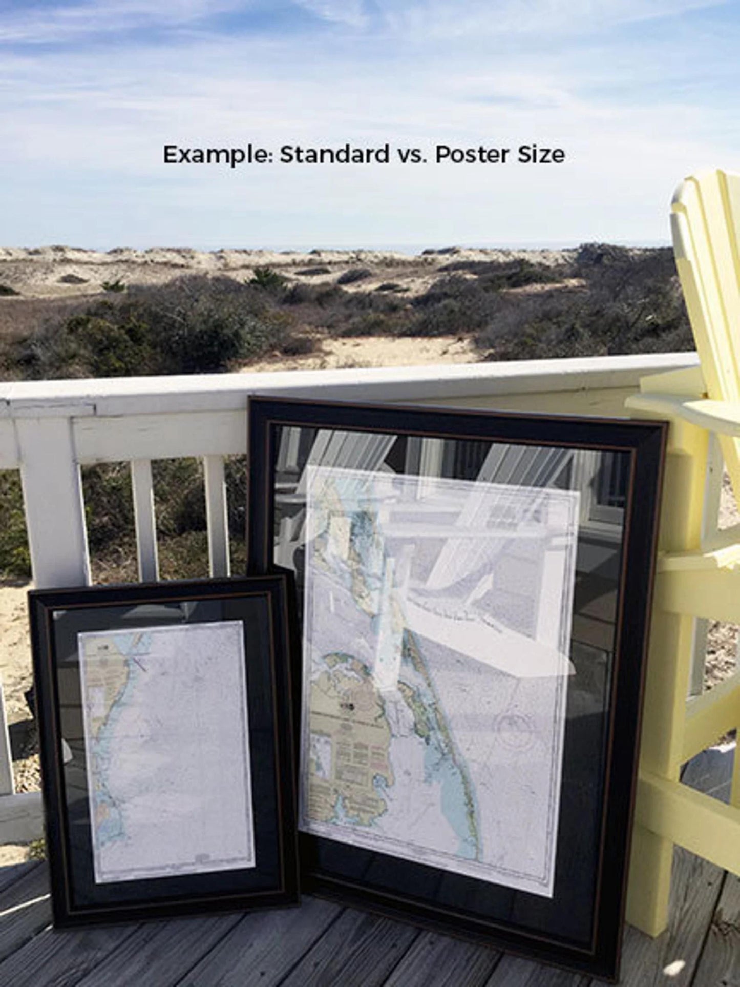
The back of the frame is finished with a paper duster for a polished look, and it comes equipped with a convenient wire hanger for easy installation. We offer two frame sizes to suit your space:
- Standard size: Approx. 24" H x 18 3/4" W
- Poster size: Approx. 36" H x 28" W
If you desire a different frame style, please don't hesitate to contact us with your preferences. We’re eager to collaborate and create a piece that aligns with your vision.
*Important Shipping Note: We provide free ground shipping for orders within the 48 contiguous states. While we do not inflate shipping costs, please reach out for custom shipping quotes if you're located in Alaska or Hawaii due to higher shipping fees.
Share