Framed Nautical Charts
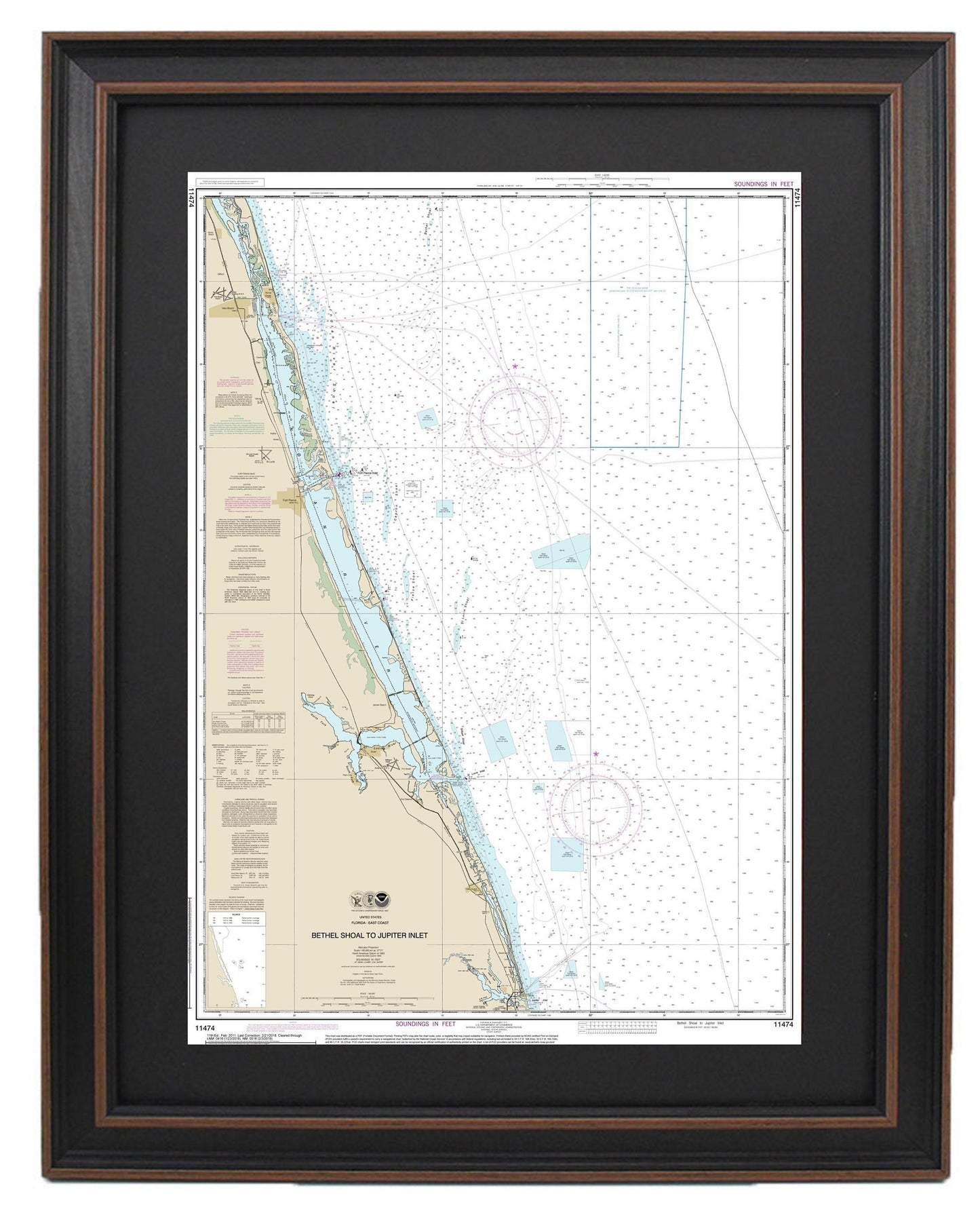
Framed Nautical Chart 11474 - Bethel Shoal to Jupiter Inlet. NOAA 11474. Handmade in the USA.
Framed Nautical Chart 11474 - Bethel Shoal to Jupiter Inlet. NOAA 11474. Handmade in the USA.
Couldn't load pickup availability
Discover the beauty of Florida's waterways with our meticulously crafted Framed Nautical Chart, which spans from Bethel Shoal to Jupiter Inlet (NOAA Chart 11474). This official NOAA Nautical Chart is a stunning representation of the intricacies of the region's marine routes, perfect for maritime enthusiasts and coastal decor.
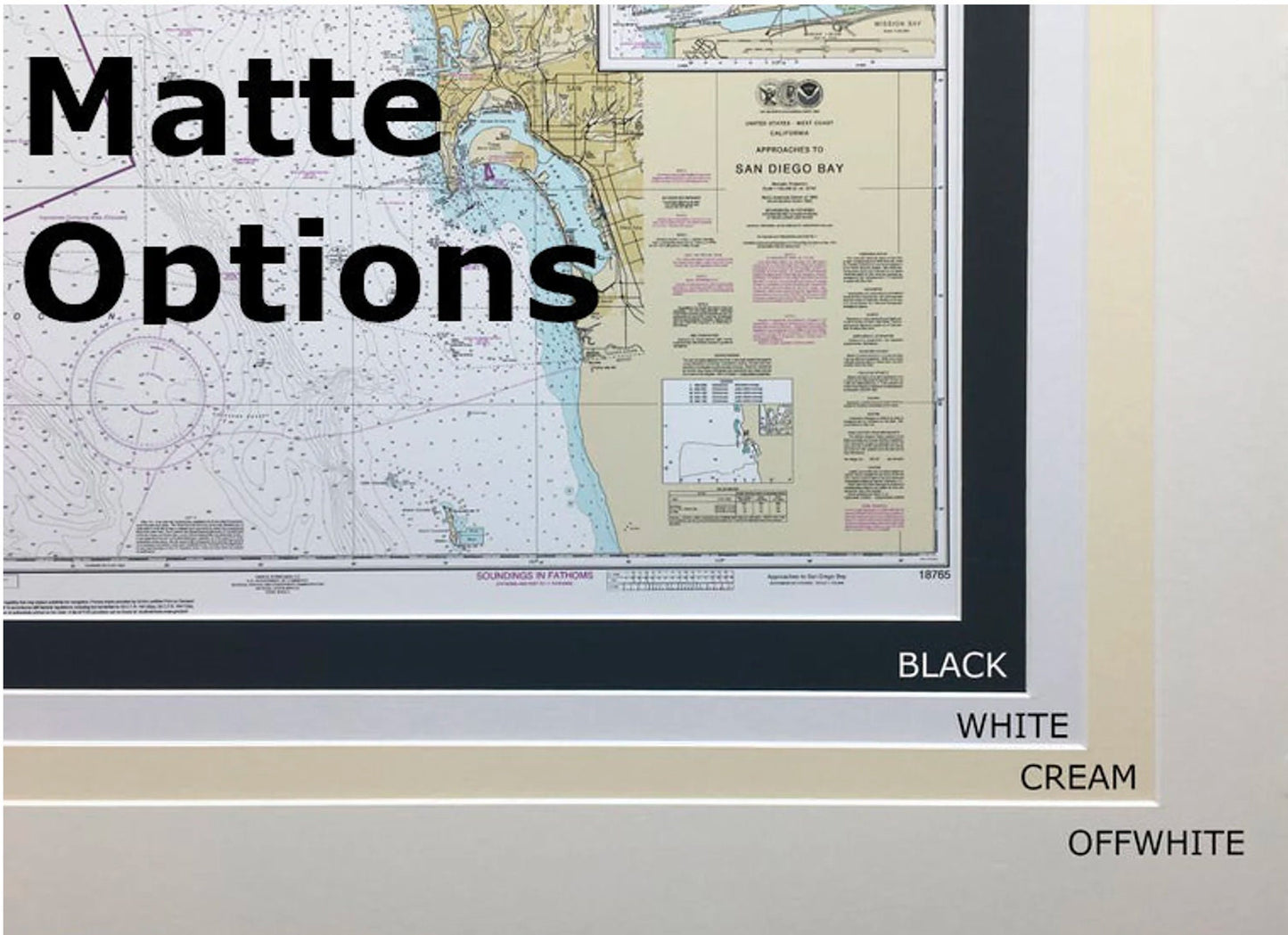
Handmade in the USA, each chart showcases exceptional craftsmanship. The nautical map is elegantly presented in a solid wood frame, enhanced by a museum-quality print made with archival paper and inks for lasting vibrancy. It features a chic black mat and is protected by a durable glass front. The back is elegantly finished with a paper duster, and a wire hanger is included for effortless wall mounting.
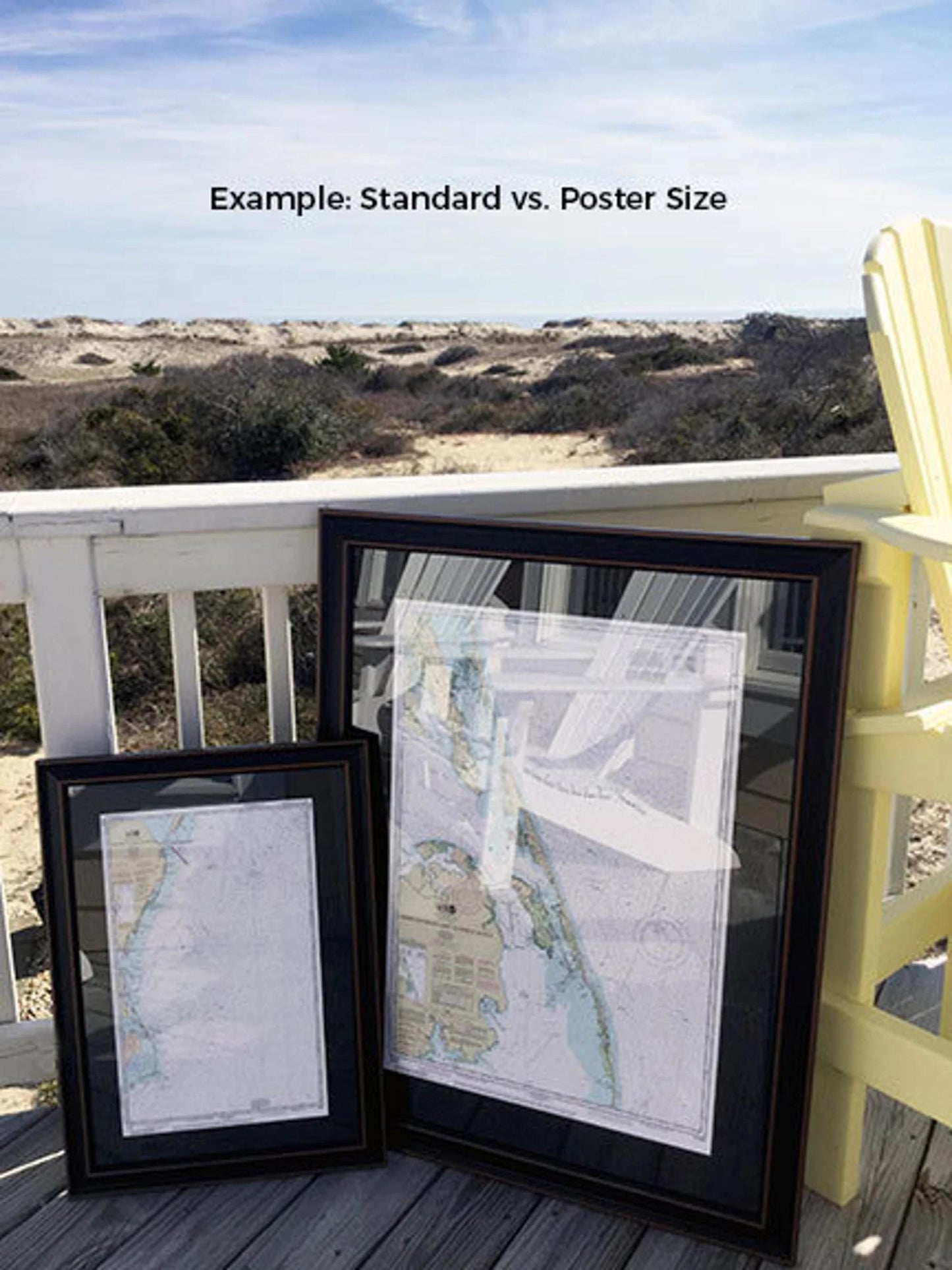
Choose from two frame sizes to best suit your space:
- Standard size: Outer frame dimensions are approximately 16 3/4" W x 24" H.
- Poster size: Outer frame dimensions are approximately 25 1/4" W x 36" H.
If you have a specific frame style in mind, please don’t hesitate to reach out—we love collaborating with customers to bring your vision to life.
*Important Shipping Note: Free ground shipping is only available for deliveries within the 48 contiguous states. We do not mark up shipping costs, but due to the higher expenses associated with shipping to Alaska and Hawaii, please contact us for a custom shipping quote.
Share